Date
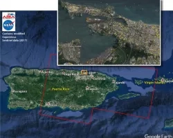
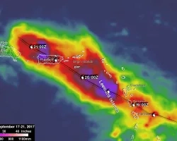
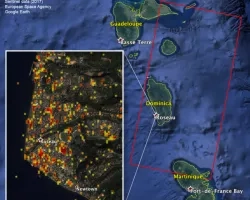
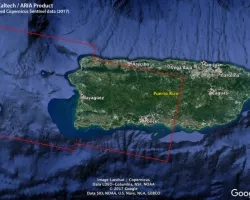
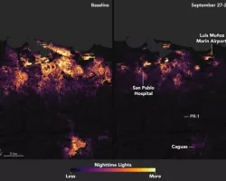
Hurricane Maria is a powerful category 5 storm that made landfall Monday (September 19th) night with a direct impact on the island of Dominica in the Caribbean / West Indies causing significant damage to structures. The hurricane is currently traveling West-Northwest towards Puerto Rico and the Virgin Islands at 9 knots, 10 MPH with maximum sustained winds of 150 knots/160 MPH. NASA is coordinating across other federal and state agencies including FEMA and the National Guard Bureau to determine what satellite assets, products, and other information could support the operational response and recovery efforts.
For the latest Hurricane Maria forecast, please visit http://www.nhc.noaa.gov/
Related Impact
Tagged: Disasters
Tagged: Disasters
Tagged: Disasters