
The International Disasters Charter has been activated by the Asian Disaster Reduction Center (ADRC) for flooding in Japan in July 2020. Per the Charter Activation, heavy rainfall has caused flooding and landslides on the Island of Kyushu, Japan. At least 16 people are reported to have been killed and 12 reported missing. The prefectures of Kumamoto and Kagoshima have been worst hit, with rivers breaking their banks and washing away homes, bridges, cars and trees. Local authorities evacuated over 200,000 people from their homes and deployed 10,000 soldiers to assist in relief efforts. Japan's Meteorological Agency said such rainfall had never been seen before in the region.
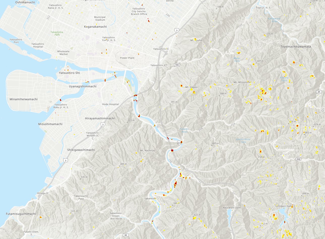
The NASA Earth Applied Sciences Disasters Program has activated to Tier 1 in support of the floods in Japan, and is monitoring the situation to determine what NASA resources and capabilities may be available to support risk management for this event. The Disasters Program is currently working with stakeholders from Sentinel Asia and the ADRC through the International Disasters Charter, to quantify flood depth, flood extent, and to identify areas damaged by the flooding.