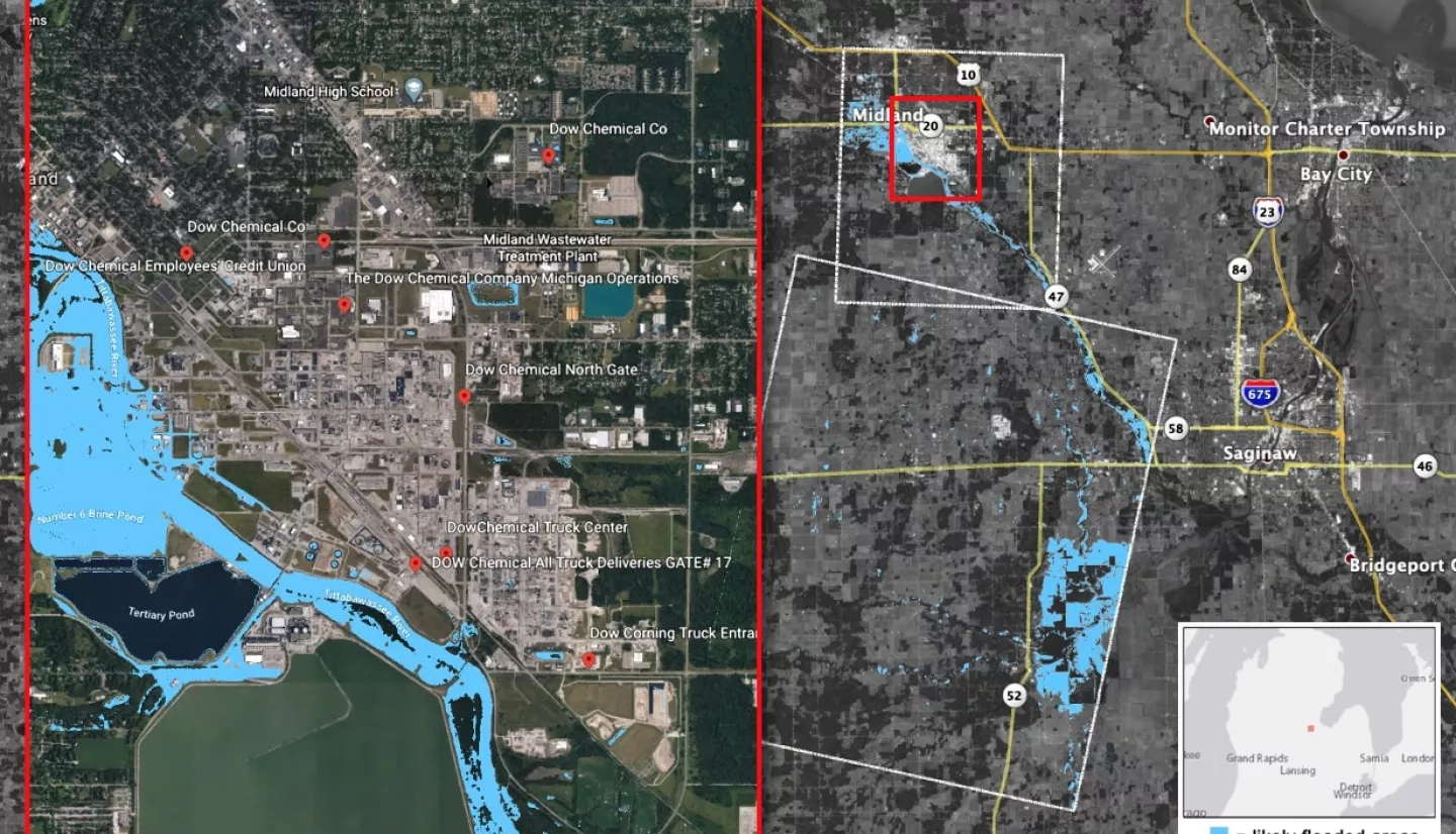
Heavy rainfall in central Michigan starting on May 17, 2020 has caused significant flooding in Midland County, with news reports indicating damage to roadways, homes and business. The governor of Michigan has declared a state of emergency and ordered more than 10,000 residents of Edenville and Sanford to evacuate. The floods have also resulted in the failure of the Edenville Dam the evening of May 19th and the Sanford Dam several hours later, causing additional flooding around the Tittabawassee River region. Flooding from the Edenville Dam is suspected to have breached the walls of Dow Chemical Facility.
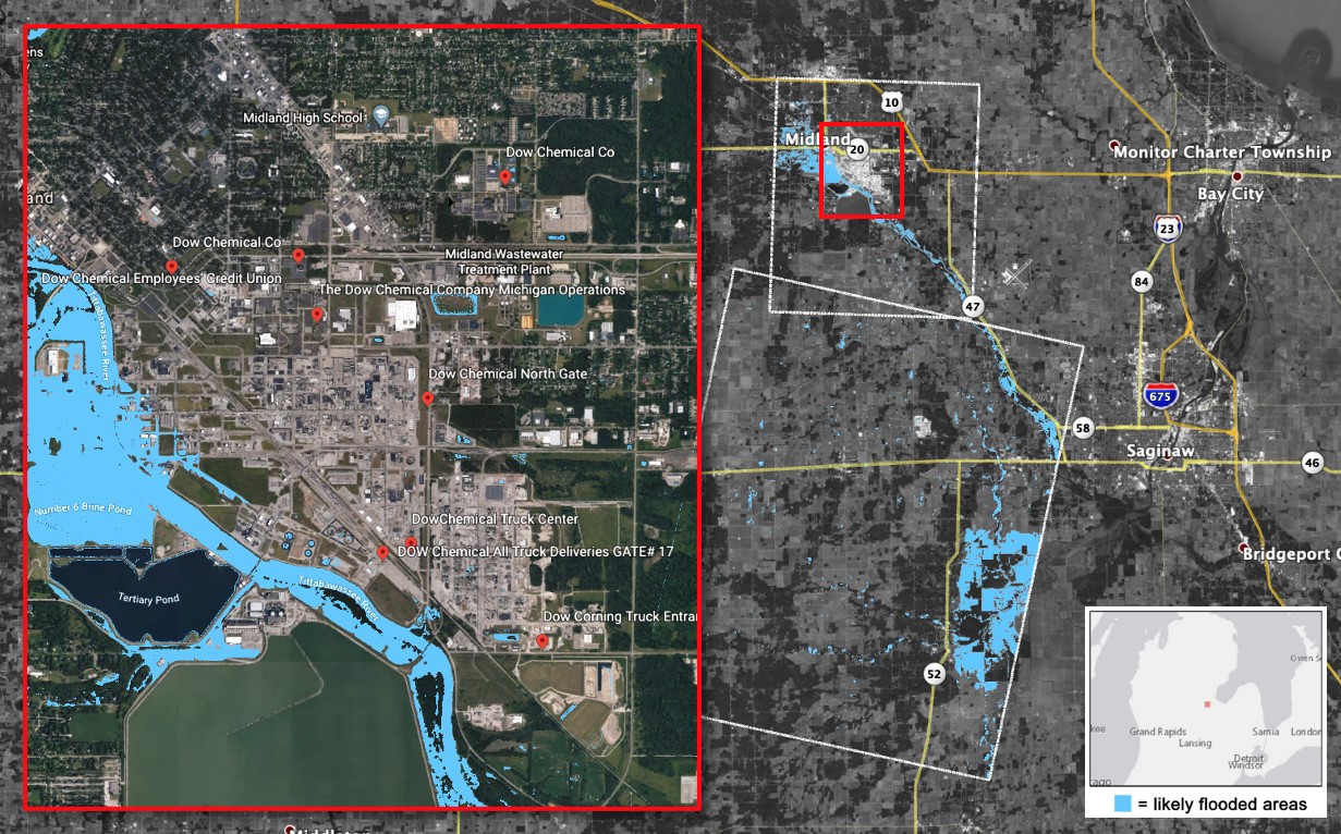
The NASA Earth Applied Sciences Disasters Program has activated to Tier 1 in support of the floods and dam failures, and is monitoring the situation to determine what NASA resources and capabilities may be available to support risk management for this event. The Disasters Program is currently aiding stakeholders from the U.S. Air Force (USAF) and the Swiss Re Group insurance company to identify potentially flooded areas using ARIA Flood Proxy Maps and assess potential damage to the Dow Chemical plant.