In the early hours of September 15, 2018, Super Typhoon Mangkhut (Ompong) blew into Cagayan Province near the northern tip of Luzon, one of the most populated of the Philippine islands. Local reports described wind speeds of 205 kilometers (130 miles) per hour. The storm stretched nearly 900 kilometers (600 miles) across, with an eye 50 kilometers (30 miles) wide. It is the strongest tropical cyclone in any ocean basin so far this year.
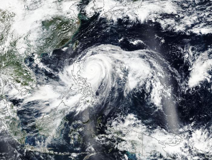
On September 14, 2018, the Visible Infrared Imaging Radiometer Suite (VIIRS) on the Suomi NPP satellite acquired a natural-color image of Mangkhut just after midday. At 8 p.m. Philippine Standard Time (12:00 Universal Time) on September 14, the U.S. Joint Typhoon Warning Center reported that the storm still had sustained winds of 145 knots (165 miles/270 kilometers per hour), with gusts to 175 knots. Maximum significant wave heights were 40 feet (12 meters).
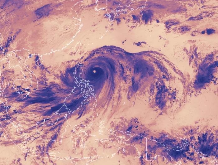
The second, false-color image shows infrared signals known as brightness temperature. This is useful for distinguishing cooler (dark) cloud tops from the warmer (whiter) clouds and water surfaces below.
Related Impact