On May 24, 2017, a series of extreme rainfall events began impacting the west and northwest regions or Uruguay. These rains caused severe flooding in the Departments of Salto, Paysandú and Artigas. By June 10th more than 6,300 people were displaced and relocated by the Uruguay’s Sistema Nacional de Emergencias (SINAE). On June 6th, the Uruguayan Government activated the International Charter on Space and Major Disasters. The NASA Disasters Program responded to this call immediately. The coordination of the response was led by the Ames Research Center (ARC) with the aid of several other NASA Centers. ARC coordinators contacted SINAE’s personnel (Fernando Traversa, Director; and Diego Moreno, Engineer in charge of the response operations for this event) to obtain an idea of the types of remotely-sensed products needed to assess the situation.
The coordinated response of the NASA Disasters Program produced a series of valuable products to the Uruguayan Government. Among these are:
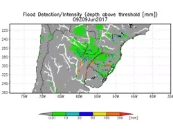
- Flood detection/Inundation maps along with Streamflow data provided by Robert Adler (University of Maryland) Figs 1-2
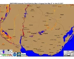
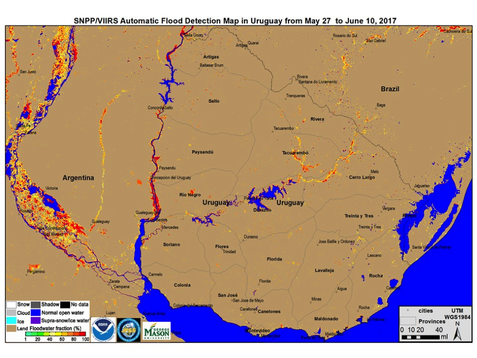
- Flood maps from May 27 to June 10th provided by Donglian Sun (George Mason University) (Fig 3)
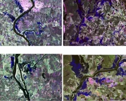
- SAR flood detection maps provided by a coordinated effort between the Goddard Space Flight Center (GSFC) and the Jet Propulsion Lab (JPL) (Fig 4)
- High spatial resolution (4m) true color visible imagery (Planet Scope) provided by our colleagues of Planet. (Figs 5-6)
We would like to give our deepest thanks to all our colleagues who provided imagery and data to our friends in Uruguay during this event.
Related Impact