Imagen
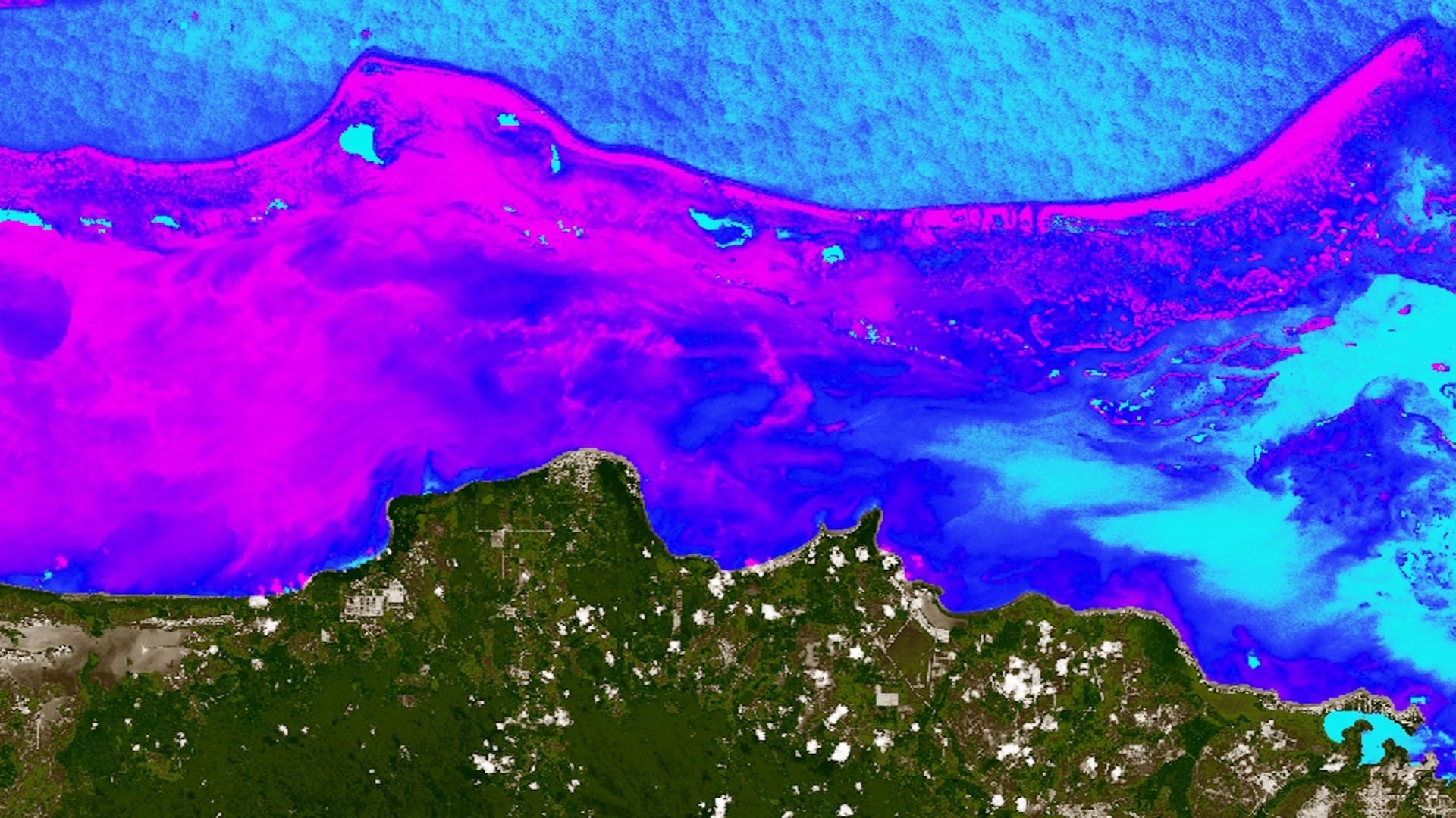
The Belize Barrier Reef is a biodiverse marine ecosystem and the largest coral reef system in the western hemisphere. The reef also provides ecosystem services in the form of fisheries and tourism and is estimated to be responsible for 12 to 15% of the nation’s gross domestic product. Retaining these ecosystem functions requires sustainable coastal management and preservation of water quality, especially in the face of global changes in climate and local anthropogenic impacts. The Belize Water Resources Team at NASA Jet Propulsion Laboratory and NASA Ames Research Center partnered with the Coastal Zone Management Authority and Institute, a Belizean governmental agency, and the Wildlife Conservation Society to evaluate water quality conditions and inform coastal management decisions. Using Google Earth Engine, we developed a tool that outputs a time series of sea surface temperature, turbidity, and chlorophyll-a concentration derived from Landsat 8 Operational Land Imager (OLI) and Sentinel-2 Multispectral Instrument (MSI), Aqua Moderate Resolution Imaging Spectroradiometer (MODIS) and Terra MODIS satellite imagery. With optical data available from 2013 onward, our partners can efficiently identify reef areas threatened by depreciating water quality, designate Marine Protected Areas and no-take zones, and conduct temporal analyses of water quality changes following environmental disturbance events, such as hurricanes. Additionally, this tool will assist in identifying indicators that may be used to measure Belize’s progress towards Sustainable Development Goals regarding marine environments. Using the tool, partners can better monitor changing water quality and make decisions accordingly in regards to sustainable resource use, coral reef conservation practices, and environmental capital.