Imagen

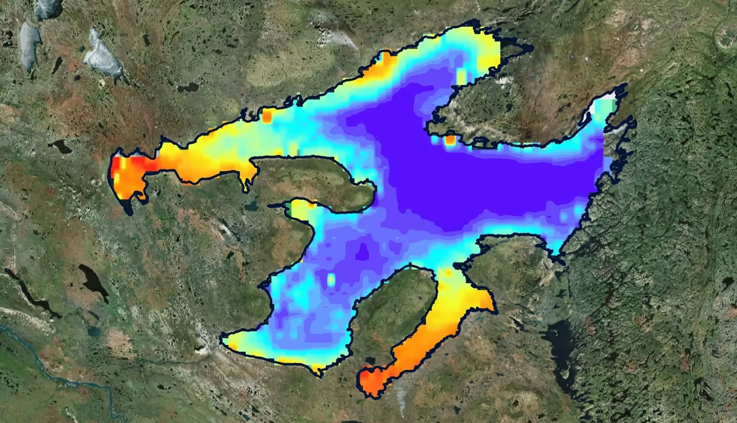
The Sahtu Dene people of Délįnę have a strong traditional tie to Great Bear Lake (GBL), which they refer to as “The Water Heart.” The indigenous community is concerned with how changes in the lake may affect their livelihoods and fisheries. Arctic lakes like the GBL, the largest lake in Canada, are sensitive to increasing global temperatures. However, assessing the changing climate’s impacts on large water bodies is challenging and requires long-term time series analyses across large datasets. The scarcity of continuous monitoring has constrained the spatiotemporal evaluation of the GBL’s responses to climate variability in past years. Most research conducted in the region is very limited and only includes temporally limited surface temperature, ice phenology, and fisheries ecology studies. To complement the previous studies in the region and support environmental monitoring done by project partners at the Délįnę Got’įnę Government (DGG) and Environment and Climate Change Canada, the fall 2018 NASA DEVELOP Massachusetts team analyzed long-term remote sensing data to assess the water quality changes of the lake over the past 20 years. Aqua Moderate Resolution Imaging Spectroradiometer (MODIS) and Sea-Viewing Wide Field-of-View Sensor (SeaWiFS) satellite imagery and ARCLake Project data were used to evaluate changes in lake surface water temperature (LSWT), chlorophyll-a, and chromophoric dissolved organic matter (CDOM) in the GBL.