Imagen
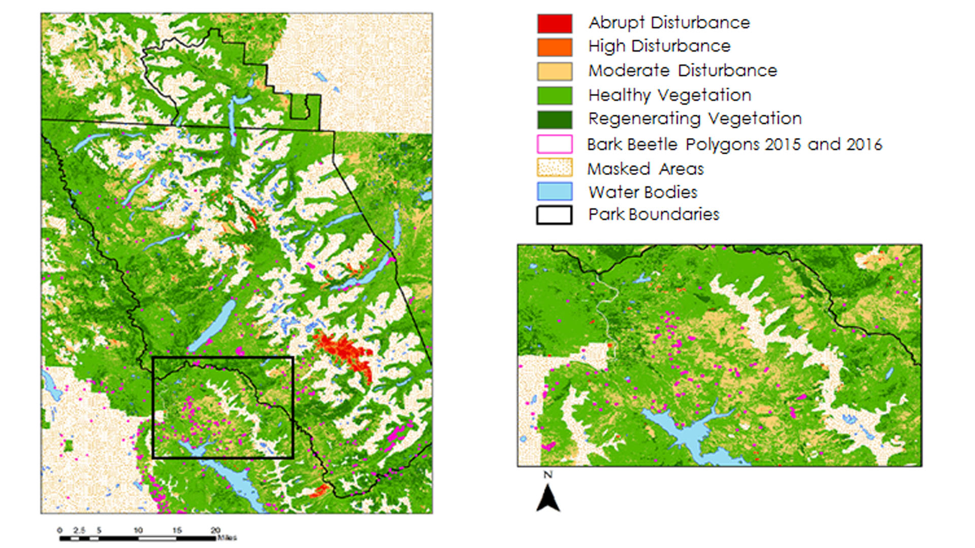
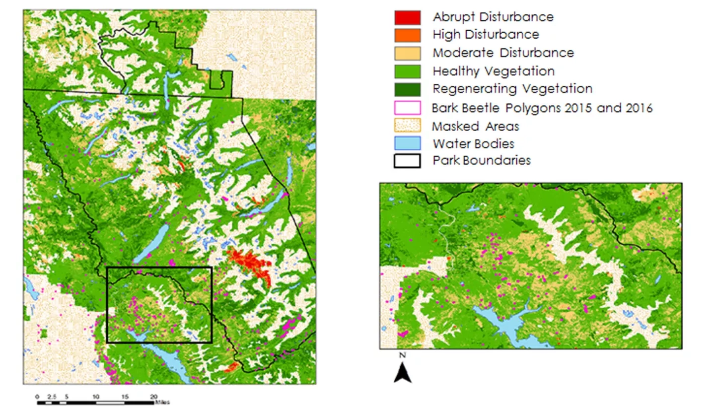
Insects and pathogens cause extensive damage to pine forests in the northwestern United States. Bark beetles in particular cause mortality in pine stands that can impact the timber industry and national parks. Previously, studies have used spectral indices derived from Landsat time series to identify insect disturbance. The team mapped landscape disturbance in Glacier National Park and Waterton Lakes National Park in Alberta, Canada from 1999-2016 using a time series of Normalized Difference Moisture Index (NDMI) and red-green index (RGI) computed from cloud-free Landsat composites. Aerial Detection Survey (ADS) polygons were used to fine tune thresholds, targeting the classification of moderate disturbance toward insect disturbance. Insects and pathogens were the primary focus of this classification scheme; however, due to the level of ambiguity in the ADS data and because NDMI is sensitive to various disturbance types, the study opted to map all moderate disturbance. To determine the thresholds for these categories, we analyzed spatial subsets of our spectral indices within ADS polygons, fire data from the National Park Service, and polygons representing healthy forest as digitized from high resolution NAIP imagery. RGI was then incorporated to further target the red stage of bark beetle attack in the moderate disturbance category. Maps of persistent disturbance over a time series of five inter-annual periods were created from the resulting maps of interannual disturbance. The study programmatically generated all maps and histograms with Python for efficiency and modularity, so that the methodology may be applied to map future outbreaks.