
- Joel T. Johnson, The Ohio State University
- Dustin Horton, The Ohio State University
The incorporation of soil moisture information into wildfire prediction is becoming increasingly important, as has been shown in recent works relating pre-season soil moisture and seasonal anomalies to wildfire activity. The use of SAR-based soil moisture products, such as those from the upcoming NISAR mission, provides the potential for soil moisture data at finer spatial resolutions than currently available on a global scale. SAR measurements can also be used throughout the pre-, post-, and active wildfire cycles for such applications as landcover classification and potential fuel loads, identification of active burn progression, and monitoring burn scar recovery.
To advance the use of SAR data for wildfire risk assessment and monitoring, the project will perform case studies in three focus areas:
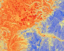
1) applying SAR-based soil moisture retrievals to wildfire prediction using both direct pre-wildfire season soil moisture measurements as well as anomalies in average soil moisture measurements,
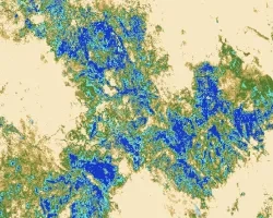
2) applying SAR-based field scale land classifications to analyze potential fuel loads in conjunction with the developed soil moisture products, and
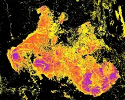
3) applying SAR-based landcover classifications for active burns and burn scars for the purposes of improved active fire and post-fire monitoring. Results from the study will be used to promote the adoption of SAR systems in wildfire risk assessment and monitoring.
Related Impact