Fire Island Water Resources (Fall 2021)
Team: Kelly Young (Project Lead), Tyler Albrethsen, Yuhe Chang, Brenna Hatch, and Lisa Tanh
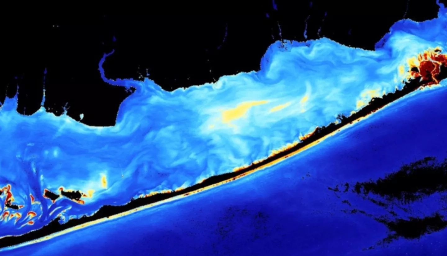
Summary: Fire Island National Seashore has experienced damaging effects as a result of coastal erosion. Erosion has become an increasingly damaging problem that has led to the destruction of park and community infrastructure, contributed to rising groundwater tables, and posed a serious threat to a globally rare holly maritime forest. Beach nourishment project efforts have been made to mitigate damage, but dredging is expensive and can be thwarted by high rates of erosion. The NASA DEVELOP team partnered with the National Park Service and Fire Island National Seashore and used imagery from Landsat 5 Thematic Mapper (TM), Landsat 8 Operational Land Imager (OLI), and Sentinel-2 MultiSpectral Instrument (MSI) to analyze turbidity and sediment dynamics through surface reflectance data from 2000-2021. Imagery was atmospherically corrected using Atmospheric Correction for OLI Lite (ACOLITE) and visualized in SeaWiFS Data Analysis Systems (SeaDAS). Additionally, shoreline change was analyzed using high-resolution imagery from WorldView-2 acquired from Maxar for pre-Hurricane Sandy on July 25th, 2010 and post-Hurricane Sandy on December 18th, 2019. The results of this analysis showed that turbidity is highest in the winter seasons. The shoreline analysis estimated total shoreline loss of about 62 acres on the ocean side, and 11 acres on the bay side of the island. These results will be used to better inform future partner-designed shoreline management projects in the face of further erosion and sea level rise.
Deliverables:
Related Impact