New York City Transportation and Infrastructure (2023 Spring)
Team: Thomas Schindelman (Project Lead), Emily Culling, Gianna Méndez Germán, Janna Chapman
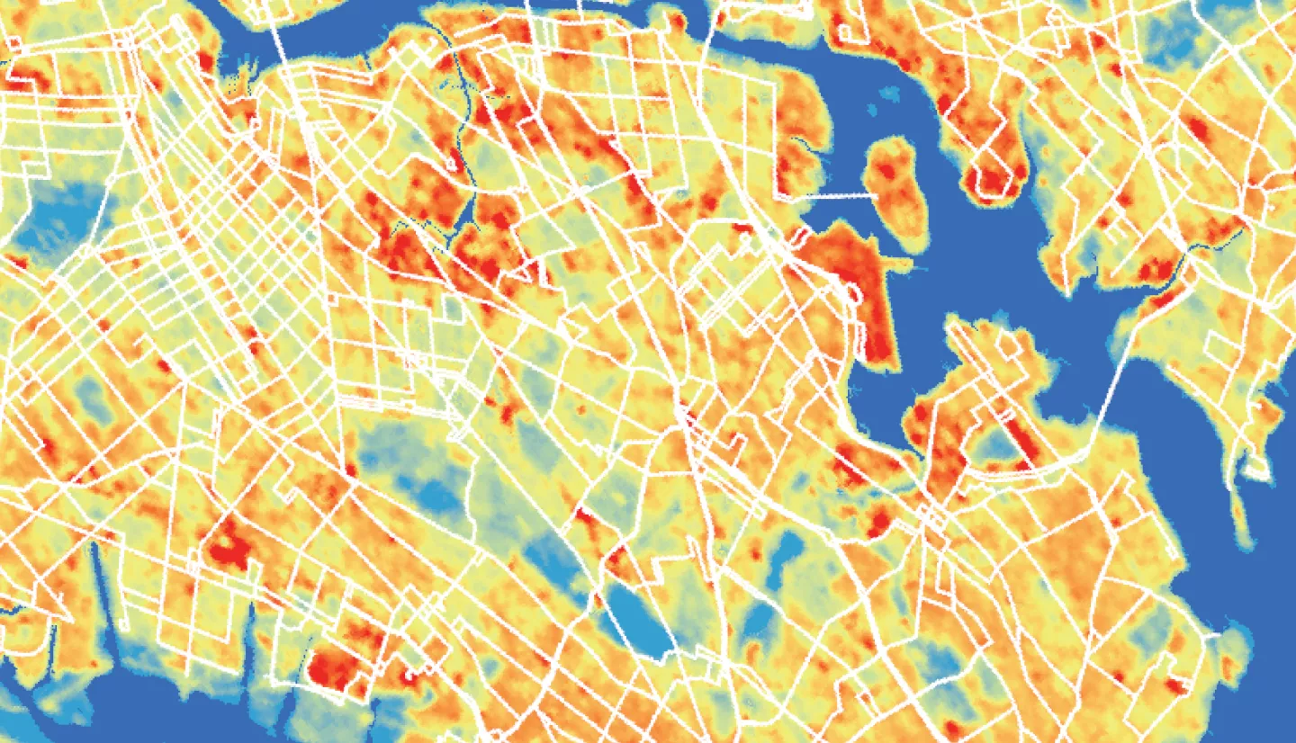
Summary: New York City, the most populous city in the United States, is threatened by exacerbated heat exposure due to the urban heat island (UHI) effect induced by its heavily urbanized environment and limited tree canopy cover. Decades of racist policy and planning have led extreme heat to disproportionately impact people of color and low-income residents, especially in the context of public transportation by bus. This NASA DEVELOP project partnered with Transportation Alternatives to identify the most heat vulnerable populations in the city, characterize the extent of urban heat, and complete an individual bus stop analysis. We utilized NASA Earth observations, including Landsat 8 Thermal Infrared Sensor (TIRS) and Landsat 9 TIRS-2 to determine UHI extent and anomalies. Leveraging data from the City of New York and the American Community Survey (ACS), we constructed a transportation-specific heat vulnerability index to understand intersecting social and economic vulnerabilities by performing a Principal Component Analysis. After identifying major hotspots in the Bronx, Queens, and Brooklyn, we modeled mean radiant temperature at the hottest and highest ridership bus stops identified by our UHI analysis to estimate thermal comfort using the Urban Multi-scale Environmental Predictor’s SOLWEIG tool. Our end products will be incorporated into Transportation Alternative’s Spatial Equity NYC dashboard and inform their community engagement strategies as they organize with residents to advocate for cooling interventions.
Related Impact