Imagen
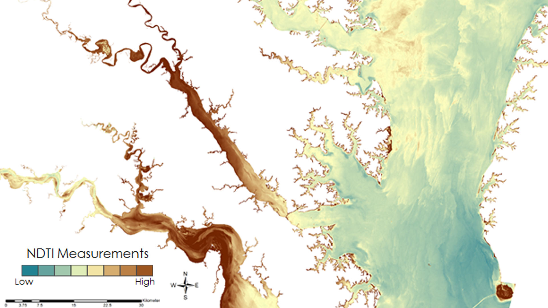
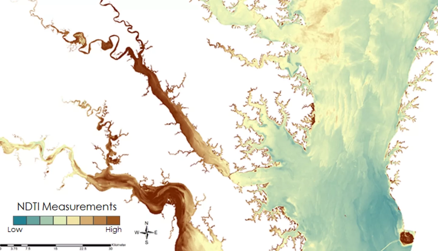
Submerged Aquatic Vegetation (SAV) is vitally important to the Chesapeake Bay, serving as one of the primary food sources for the organisms that inhabit the Bay. This project evaluated the efficacy of remote sensing applications as a tool to monitor water quality parameters, specifically turbidity, to indicate areas that can potentially support healthy seagrass populations in the Chesapeake Bay. The resources and methods included visual analysis of the Bay utilizing Landsat 5 Thematic Mapper (TM) and Landsat 8 Operational Land Imager (OLI). By correlating the Landsat-derived Normalized Difference Turbidity Index (NDTI) to the Virginia Institute of Marine Sciences' (VIMS) in situ monitoring data, a model was created that can be used to provide an estimate of water clarity throughout the entire bay. This model focuses on providing an additional resource for the Virginia Department of Environmental Quality (DEQ) for use in monitoring changes in water turbidity in the Chesapeake Bay and aid in monitoring efforts of SAV growth locations and Total Maximum Daily Load (TMDL) calculations of the Bay.