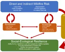
This project explores the potential of Remote Sensing (RS) and spatial data to advance Environmental Justice, with a focus on tribal land and water resources management. By studying past projects that effectively employed spatial data and GIS-based tools in resource management, we aim to understand the degree of tribal community involvement in these initiatives. Our dedication to cultivating a participatory approach guarantees that tribal voices and perspectives stay at the forefront of this study, resulting in innovative solutions that improve Environmental Justice.
Methodology
The proposed Landscape Analysis is motivated by the premise that the use of spatial data can complement existing land management decision-making methods now used by the Tribes. This analysis of the existing landscape is guided by the following research questions:
1. How can remote sensing and geographical data be used to promote environmental justice in land and water resource management?
2. What are the existing uses and limitations to using geographical data in California tribal communities?
3. Do the communities feel included in programs that use spatial data and GIS-based tools to manage forest and water resources?
Community/Stakeholder Engagement
The engagement of tribal groups and stakeholders is fundamental to this project. We want to foster meaningful discourse by ensuring that tribal members' interests and concerns are represented throughout the research. Their active participation will provide essential insights into spatial data utilization and its potential impact on resource management, supporting a collaborative and equitable approach.
Environmental Justice Relevance/Impact
We hope to achieve Environmental Justice by investigating how remote sensing and spatial data may help tribal land and water resource management. Our first findings and recommendations highlight the potential for remote sensing applications like water quality monitoring, vegetation mapping, and identifying locations for restoration and cultural preservation. We expect that our research will empower indigenous communities by providing them with useful information and tools for long-term resource management.
Deliverables
This study will result in a report that will give light on the challenges that tribal groups face, such as image resolution, data access, time limits, IT infrastructure, and data sovereignty as well as including suggested strategies, policy suggestions, and capacity-building activities to solve the identified difficulties and promote increased use of spatial data in tribal settings.
