Team Members: Travis Flohr; Penn State University (Co-I); Peter Marcotullio; Hunter College (Co-I); Andrew Reinmann; Hunter College (Co-I); Rosy George; Hunter College (Graduate Research Assistant); Marissa Fein; Hunter College (Graduate Research Assistant); Andrew Kittredge; Hunter College (Graduate Research Assistant); Annie Carforo; WE ACT (Community Liaison); Tiffany McQueary; I Love Greenville (Community Liaison)
Executive Summary: Urban heat is a known problem, and cities need to plan and prepare for its serious public health and energy consequences. Despite the extensive progress in the research and science of urban heat, its causes, its solutions, and its impacts on our vulnerable communities, local governments generally still need to establish processes to incorporate this science into planning and policymaking. In partnership with two local governments and two community groups, this project aims to create a data portal to provide accessible information about existing urban heat conditions and their mitigation strategies to these decision-making and advocacy stakeholders. One of the main gaps in facilitating this process is that urban heat data and science are complex and challenging to retrieve and interpret.
We are developing new algorithms and data pipelines to automate the generation of key urban heat data products from earth observation data, weather stations, and socioeconomic variables to generate heat vulnerability maps. We are also developing core analytical models to connect heat vulnerability and heat mitigation strategies. The research objectives include:
a) To develop a data pipeline for automated generation of heat risk data, including:
i. A heat exposure map as a modeled product of surface and ambient temperatures.
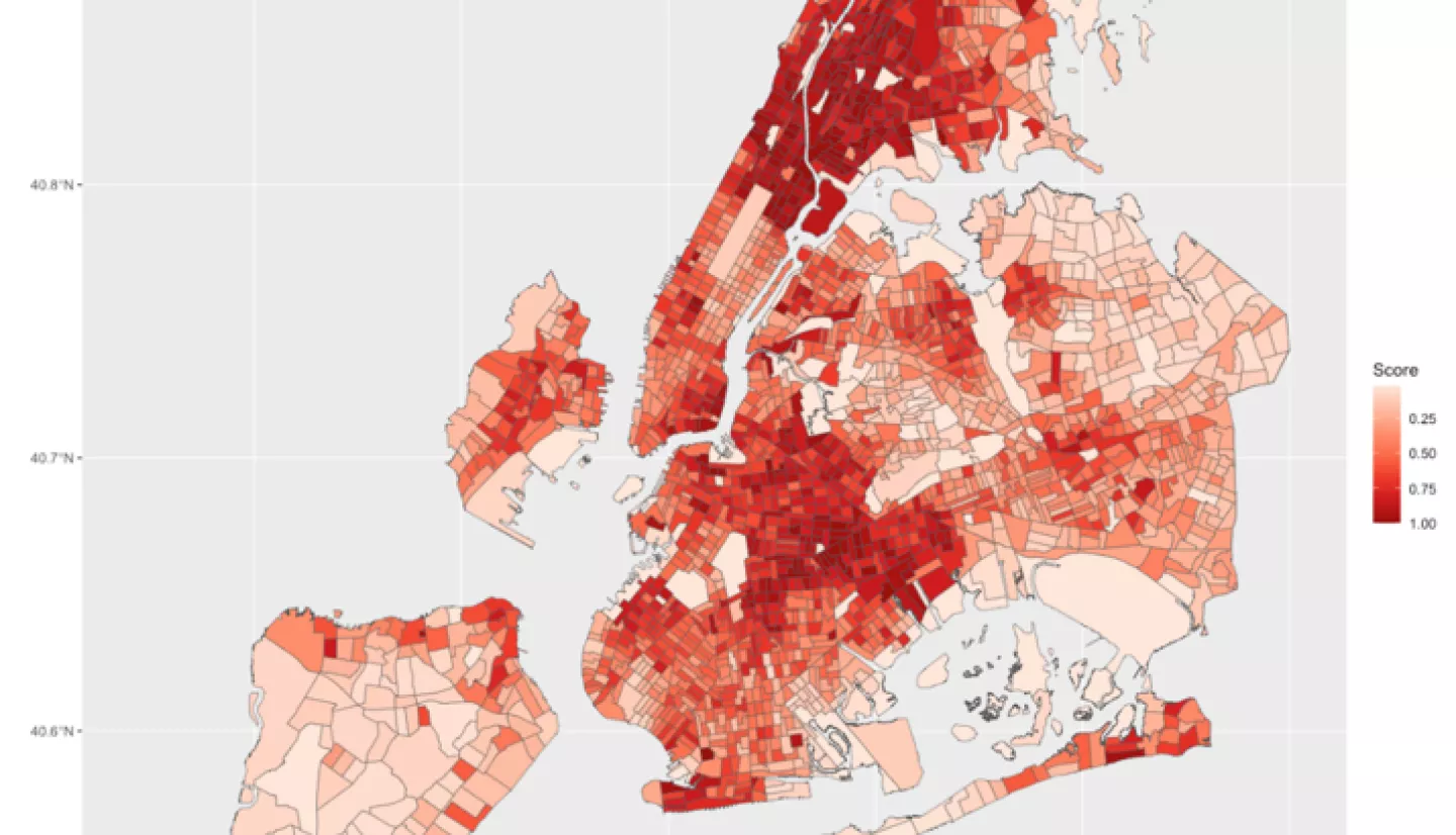
ii. The existing conditions of the heat vulnerability index, which is a product of social vulnerability and heat exposure.
iii. A historical and existing conditions map of surface reflectivity (narrow-band to broadband).
iv. A tree cover distribution map and its simulated heat mitigation impact.
b) To incorporate the mechanisms of urban heat-related decision-making processes of local governments into an interactive portal.
To develop guidelines for communicating usable urban heat-related knowledge to local governments and community groups through story maps and other visualization methods.
Related Impact