Imagen
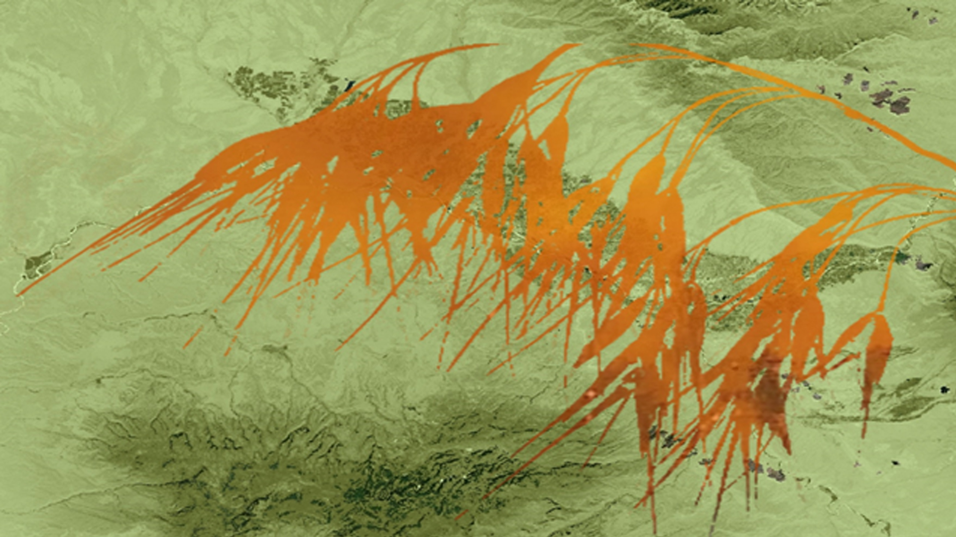
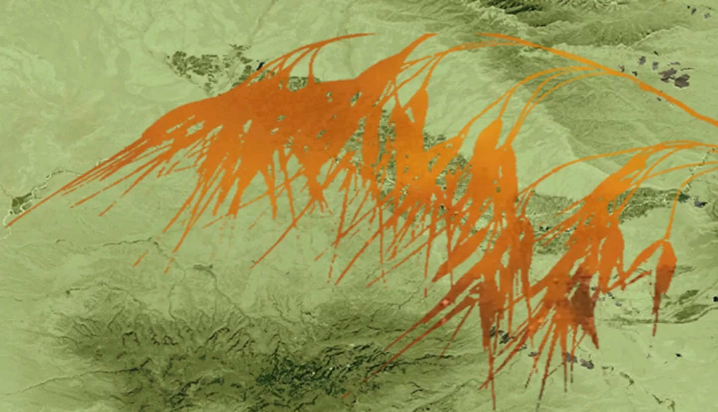
Bromus tectorum, otherwise known as cheatgrass, is an invasive grass from Europe that has increased its presence all over the world by out-competing native grasses due to its adaptability and lifecycle. During the end of its life cycle, typically occurring in the summer, its flammable remains often create the conditions for forest fires to start early in the season. This alters native wildlife's previous response to wildfires and increases the overall frequency of fires. As a result, cheatgrass often disrupts the necessary recovery time for native wildlife after habitat destruction. This NASA DEVELOP project utilized Landsat 5 TM, Landsat 8 OLI and TIRS, Terra MODIS, and Sentinel-2 data to study the spread of cheatgrass throughout the Colorado National Monument and the surrounding area to determine locations at risk of being invaded by cheatgrass. The results of the study included historical and current cheatgrass population maps, multi-criteria evaluation, (MCE) analysis, and forecasted cheatgrass spread. The MCE analysis assessed the factors and constraints that contribute to the vulnerability to cheatgrass invasion. The results from this project will assist the National Park Service in improving their monitoring and management efforts and help contribute to the prevention of cheatgrass in Colorado National Monument.