Imagen
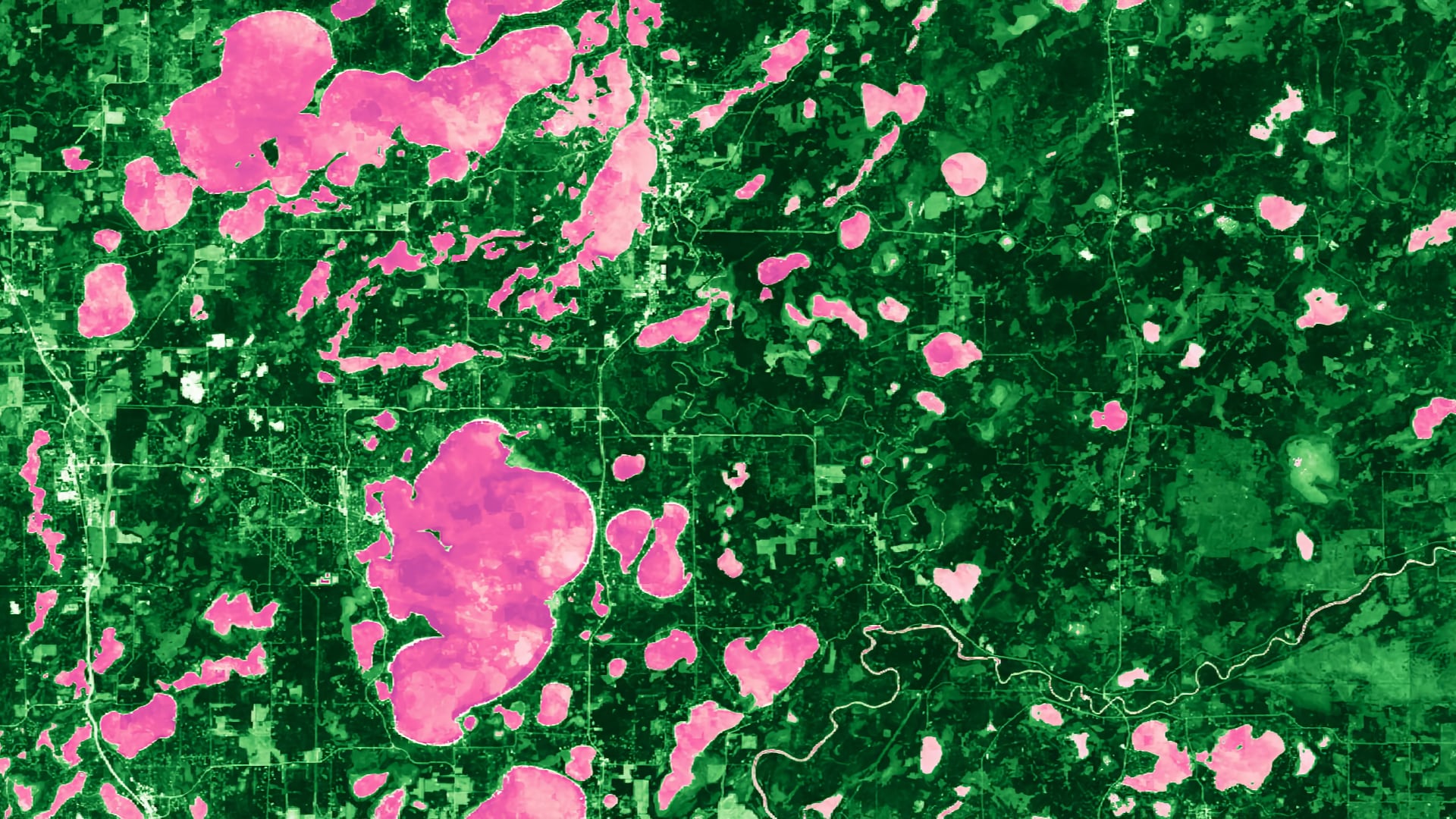
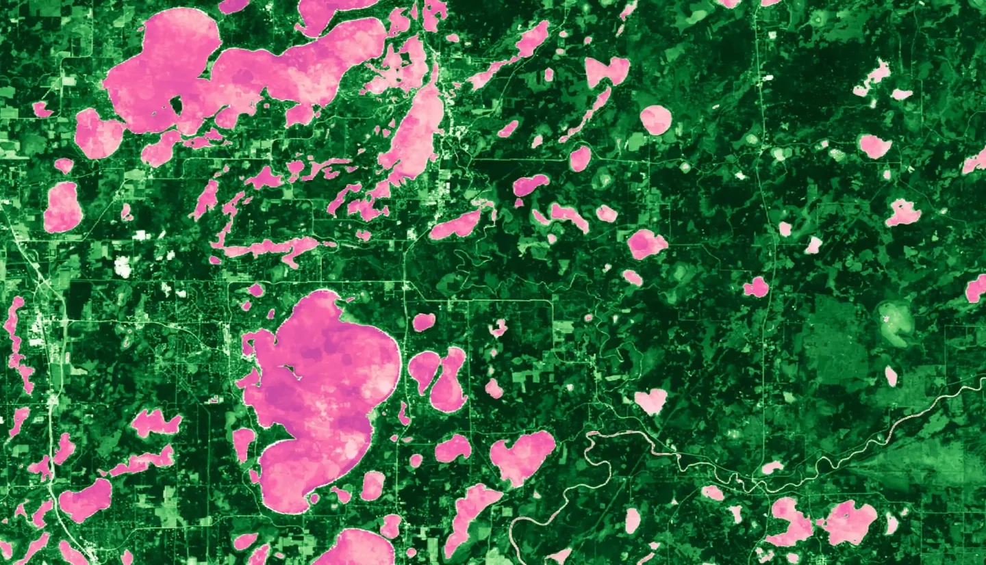
Wetlands are a critical feature of our landscape for the ecological services they provide, including protecting water quality, providing habitat to rare species, mitigating erosion, and providing opportunities for recreation. Despite this, wetlands are facing increasing threats from a variety of anthropogenic sources, including pollution, change in climate, and commercial development. Although an accurate baseline inventory of wetland extent is essential for addressing these threats and quantifying future wetland change, traditional wetland mapping methods are time intensive, costly, and difficult to implement on a large scale. Here we show that statewide, fully-automated wetland mapping is possible to a high degree of accuracy by combining recent advances in remote sensing and cloud computing. Using a multi-source, multi-temporal, object-based random forest classification approach in Google Earth Engine, we generated 30 m resolution maps of wetland extent and change for the growing seasons (May through September) of 2017 and 2018 in Minnesota. In particular, inclusion of Sentinel-1 C-Band Synthetic Aperture Radar (C-SAR) composites, Landsat 8 Operational Land Imager (OLI) composites, and a topographically derived wetness index allowed us to achieve and overall accuracy of 87% when compared to the National Wetland Inventory. Our partners included US Fish and Wildlife Service (USFWS) National Wetlands Inventory (NWI), Minnesota Department of Natural Resources (MN DNR), Environmental Protection Agency (EPA), Ducks Unlimited (DU), National Oceanic and Atmospheric Administration (NOAA) Office for Coastal Management, and the University of Minnesota (UMN). We anticipate that our tool can be of immediate use to these end users in Minnesota who rely on accurate wetland data to inform their research, policy, and development decisions. Furthermore, these methods can quickly be applied to any region of the United States for which adequate training data exists.