Bridgeport Urban development (2024 Spring)
Team: Silas Kirsch (Project Lead), John Hocknell, Maggie Roseto, Char Tomlinson
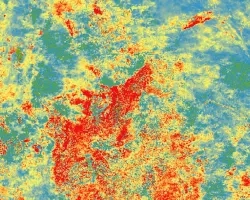
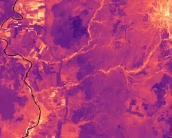
Summary: Urban environments face hotter temperatures than suburban and rural areas due to higher concentrations of impervious surfaces, heat-retaining buildings, and lack of green space. Bridgeport, Connecticut, which was formerly a national manufacturing hub, is now the densest and most populous city in the state. Bridgeport experiences hotter temperatures, exposing its residents to more extreme temperatures than the surrounding affluent suburbs. Extreme heat affects the health of those exposed to it and intensifies energy demands. Understanding temperature differences is the first step in effectively directing mitigation efforts. Our partner, Groundwork Bridgeport, along with the Yale Urban Design Workshop, are planning a “cool corridors” project, implementing cooling infrastructure to combat urban heat. We used Landsat 8 Thermal Infrared Sensor and Landsat 9 Thermal Infrared Sensor-2 data to conduct a Land Surface Temperature analysis in Google Earth Engine for the county of Fairfield. A Principal Component Analysis was performed to identify indicators of social vulnerability in Bridgeport. We used the SOlar and LongWave Environmental Irradiance Geometry model to identify felt heat on the block level to inform where the partner should locate their cooling interventions to ensure they are most effective and equitable. We focused on the East Side of Bridgeport, which we found was 10 degrees hotter than other areas of Bridgeport and the neighboring town of Fairfield. We integrated our findings using Earth observations and additional sociodemographic and climate data into final communication products for our partners which will facilitate their selection of candidate locations for their Cool Corridors project.


