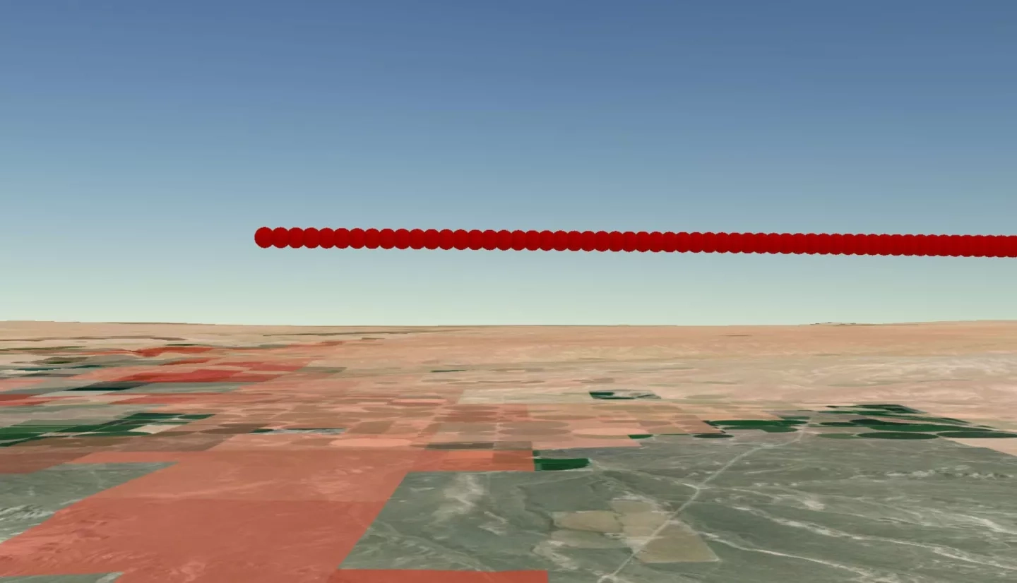
Wildfire smoke has long-lasting impacts on public and environmental health. Currently, agencies that monitor smoke base their decisions on an analysis of how fires burn, the direction the smoke moves from the fire source, and unverified estimates of mixing height. Mixing heights describe the maximum altitude to which a smoke plume rises. Satellite imagery provides more continuous and accurate coverage of mixing heights than current in situ methods. Thus, the team developed a software tool that processes and extracts mixing height observations from Cloud-Aerosol Lidar and Infrared Pathfinder Satellite Observations (CALIPSO) Vertical Feature Mask granules. The team partnered with the National Oceanic and Atmospheric Administration’s National Weather Service, the Bureau of Land Management’s National Interagency Fire Center, and the National Park Service’s Fire Management Program Center to analyze historic fire events in southern Idaho. To do so, they used Suomi National Polar-orbiting Partnership (Suomi NPP) Visible Infrared Imaging Radiometer Suite (VIIRS), and Terra and Aqua Moderate Resolution Imaging Spectroradiometer (MODIS) to verify where a CALIPSO pass intersects thermal anomalies and smoke plumes. The software extracts features of relevance from the hdf file of each CALIPSO transect to locate layers of continuous aerosols. The maximum altitude at which the aerosol ends is recorded as the mixing height, along with a matching latitude and longitude. The satellite-derived values can be used to validate past mixing height predictions and evaluate the accuracy and systematic bias of different estimation methods. These results may allow agencies to make better comparisons and subsequent smoke pollution management, prevention, and public health decisions if the spatial and temporal differences between predictions and observations can be resolved.
7079
Related Impact
Tagged: Urban Development, Tagged: DEVELOP
Tagged: DEVELOP, Tagged: Ecological Conservation
Tagged: DEVELOP, Tagged: Wildland Fires