Imagen
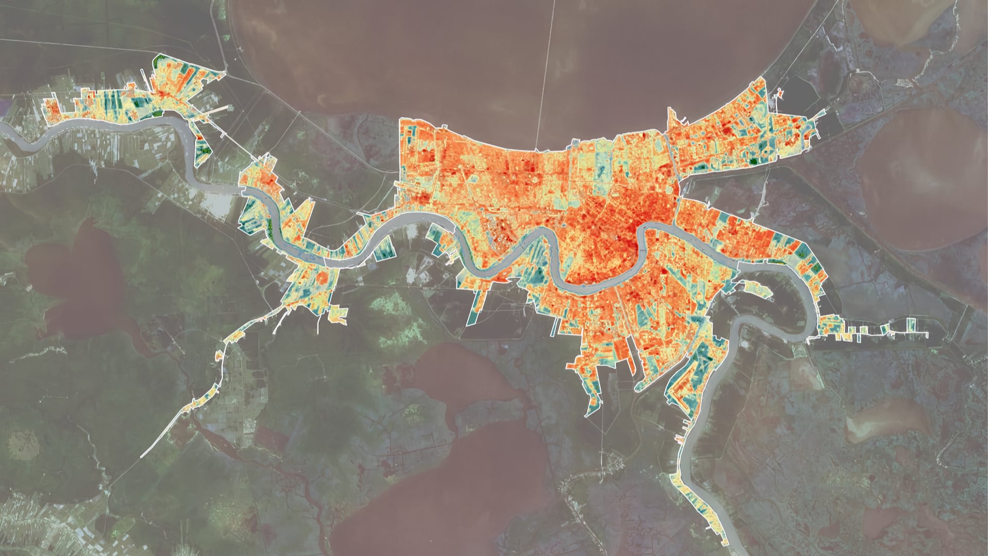
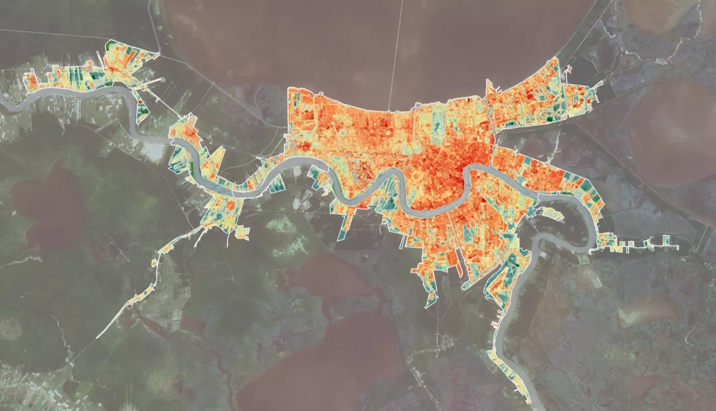
The urban heat island (UHI) effect occurs when non-vegetated surfaces trap heat during daylight hours, increasing the overall temperature of urbanized cities relative to adjacent rural areas. Excessive heat can increase the likelihood of heat stroke or dehydration, especially in vulnerable populations without access to adequate cooling mechanisms and in residents with medical complications that reduce heat endurance. This research used remotely sensed imagery from Landsat 5 Thematic Mapper (TM), Landsat 7 Enhanced Thematic Mapper Plus, Landsat 8 Operational Land Imager (OLI), and Landsat 8 Thermal Infrared Sensor (TIRS) to map land surface temperature (LST) in relation to urban and vegetated surfaces. The team produced a land cover classification of the New Orleans metropolitan area to quantify the extent of gray infrastructure and tree cover canopy. The team then produced snapshot LST datasets to visualize annual heating trends for the summer months of each year between 2000 through 2018. These LST data, overlaid with NDVI and land cover classification maps, identified “hot spot” areas prone to excess heat and calculated their proximity to urban areas and vegetated surfaces. Finally, the team produced a heat vulnerability analysis map that determined spatial relationships between areas prone to severe urban heat and Census Tracts with large populations of residents identified as vulnerable due to income, age, and education. Our project provided the Louisiana Public Health Institute with end products that will be used in combination with clinical health data to improve New Orleans’ heat mitigation strategies and sustainability efforts.