Imagen

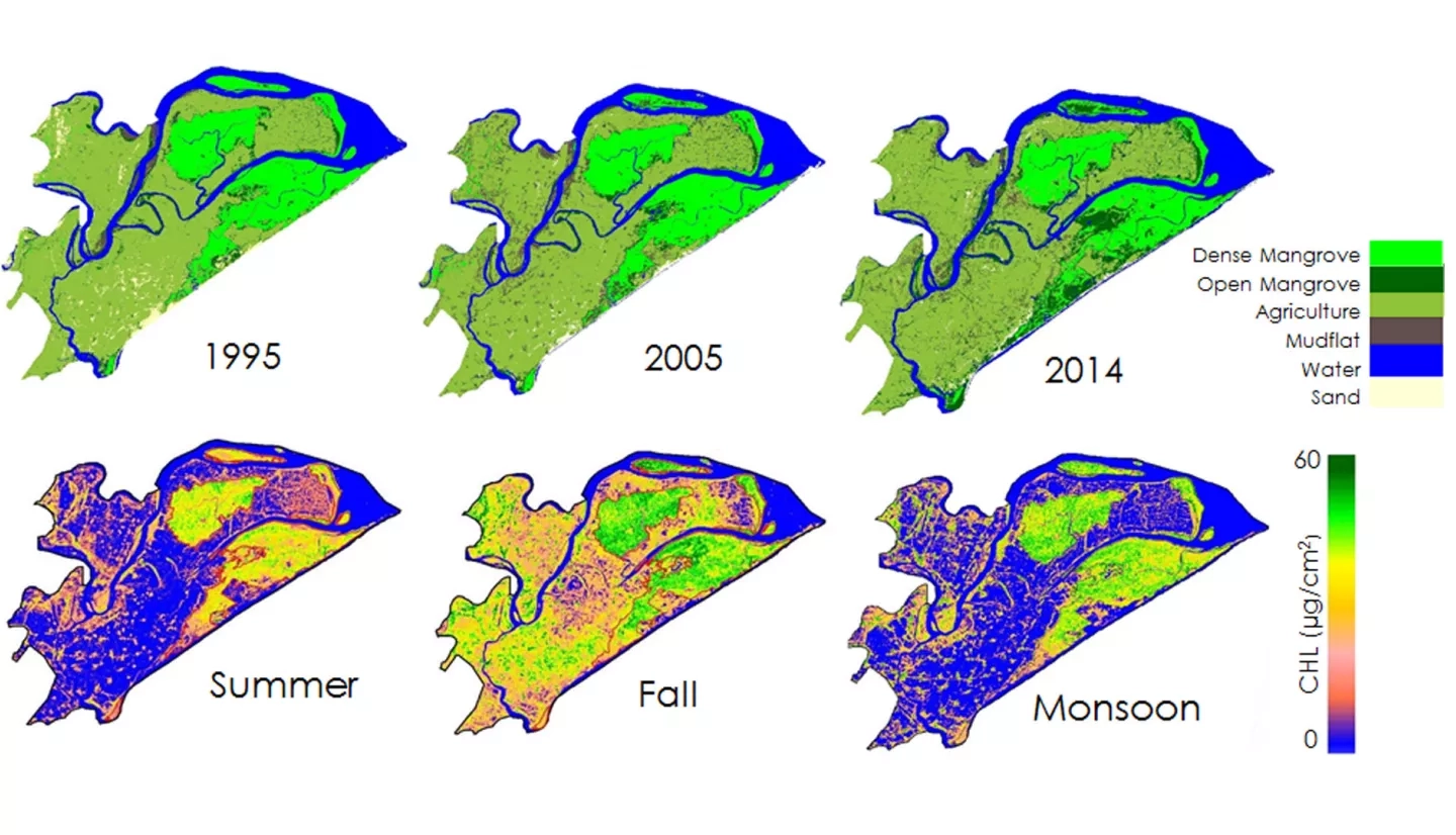
Mangroves, one of the most productive ecosystems on Earth, play a major role in coastal ecosystem processes, from mitigating erosion to acting as a barrier against tidal and storm surges associated with tropical cyclones. India has about 5 % of the world's mangrove vegetation, over half of which is found along the east coast of the country. Chilika Lagoon and Bhitarkanika Wildlife Sanctuary are Ramsar sites of international wetland importance, situated in the state of Odisha along the east coast of India. Chilika Lagoon holds three small, but distinct mangrove patches, while Bhitarkanika Wildlife Sanctuary has several large, dense patches of mangroves. There is growing concern for the effective management and conservation of these mangrove forests. This study demonstrated the use of a suite of satellite data (Terra, Landsat, and Sentinel-1) for meeting the following objectives: 1. Derive a long-term spatio-temporal phenological maps of the biophysical parameters (chlorophyll, leaf area index, gross primary productivity, and evapotranspiration); 2. Analyze long-term spatio-temporal variability of physical and meteorological parameters; 3. Document decadal changes in mangroves area estimates starting from 1995 to 2017 using Landsat and radar data. The time series developed in this study revealed a phenological pattern for mangrove biophysical characteristics. Historical analysis of land cover maps indicated a decrease in dense mangrove area and an increase in open mangrove area and fragmentation. The results of this study will be used as an efficient biophysical mapping and monitoring protocol for mangrove forests in restoration decision making.