Team: Sandy Ward (Mālama Puʻuloa) Donn Viviani (Leeward Community College) Mia Comeros-Raynal (Water Resources Research Center at the University of Hawaiʻi at Mānoa) Dingyi Liu (Department of Urban and Regional Planning at the University of Hawaiʻi at Mānoa) Austin Allen (Department of Geography at the University of Hawaiʻi at Mānoa) Lucie Schrager (Department of Geography at the University of Hawaiʻi at Mānoa) Brandon dela Cruz (Global Environmental Studies program at the University of Hawaiʻi at Mānoa – graduated Spring 2023)
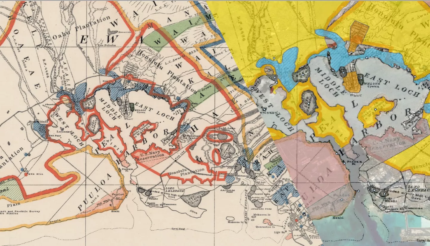
Executive Summary: Understanding how pollutants move through ecosystems and accumulate is an essential component of supporting healthy coastal ecosystems and communities. Different types of land use can result in the introduction of unique suites of toxins into the environment, which means that in the absence of comprehensive monitoring programs, knowing how land was used in the past is a critical element of anticipating risk at present. In Hawaiʻi, Puʻuloa (Pearl Harbor) was once known for its numerous fishponds, calm waters, and abundant streams, but through time the land use in this area has shifted, causing changes not only to the landscape but also the health of the surrounding ecosystems and communities. Intensive agriculture (e.g., sugarcane), industrial development, military installations, and dense urbanization have all altered the ecosystems and introduced unique sets of contaminants into the environment. In this study we aim to understand how different types of land use have introduced contaminants into the ecosystem over time and whether these pollutants may be disproportionately affecting vulnerable communities.
To do this, we aggregate and translate historic maps to develop layers of historic land use and analyze changes in land use over time in Puʻuloa. We are working with Mālama Puʻuloa, a local nonprofit organization, and other community groups and resource stewards to host a community workshop to get feedback on the map translations and incorporate local knowledge into the assessment. We then use human health risk assessment methods to develop contaminant profiles based on the historic and current land use that represent the estimated and, when possible, measured contaminants in the area. We use socioeconomic data to evaluate the vulnerability of different communities in Puʻuloa and use earth science data to examine how this vulnerability may shift with climate change impacts, such as sea level rise and flooding. At the end of the project, we will host a training workshop where students and community members can learn how to use the tools developed in this project, as well as other freely available geospatial data that may inform their future decision making and management.
Related Impact