Imagen
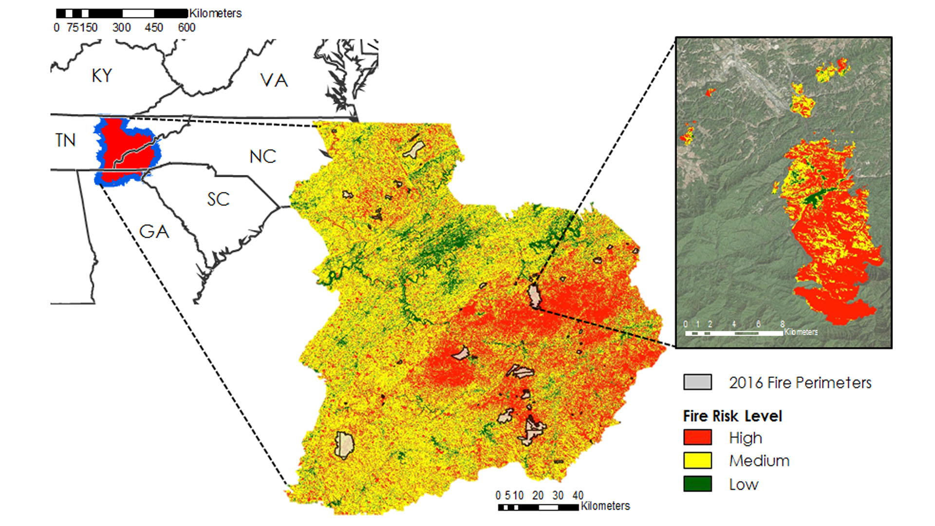
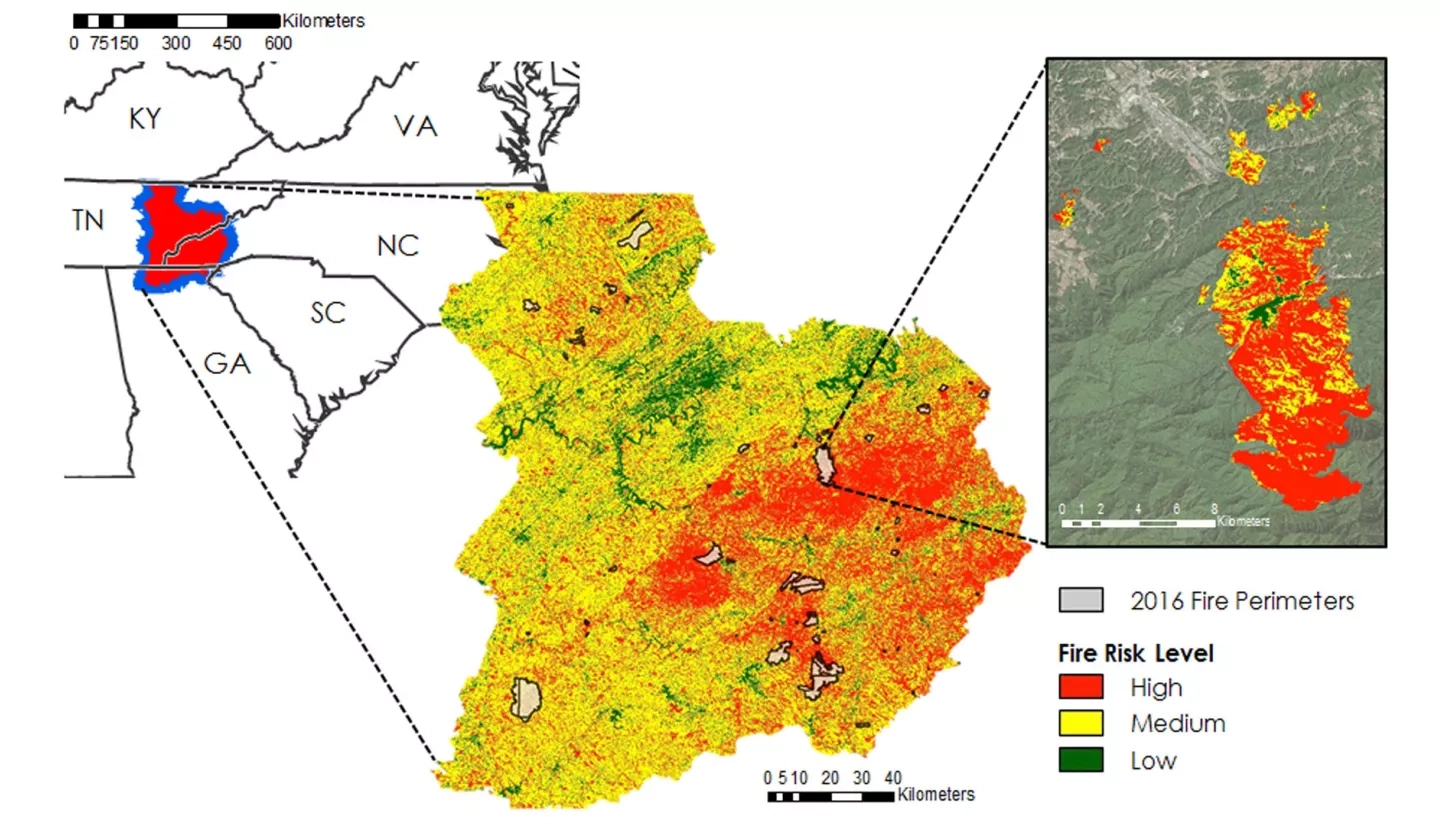
Wildfires in the southeastern US are less understood compared to other portions of the nation. In October and November of 2016, over 60 individual wildfires ignited among seven states in the Southern Appalachian region. These fires damaged hundreds of buildings, caused numerous power outages, and resulted in several fatalities. The devastating effects led to the evacuation of cities such as Gatlinburg and Pigeon Forge, TN and highlight the need to improve understanding of fire-susceptibility and risk in the southeastern US. The US Forest Service requires a thorough understanding of wildfire vulnerability, damage, and recovery to effectively help local communities respond to and prepare for these unfortunate events. The University of Georgia NASA DEVELOP team partnered with US Forest Service's Southern Research Station to assess vegetation dynamics before and after the 2016 major wildfire events, focusing on GA, NC, and TN. This was accomplished by utilizing Landsat 8 OLI, Terra ASTER, and Terra MODIS data to evaluate land cover changes and air quality from October to December 2016 and assess the severity of these fires. In addition to physical environmental parameters associated with the fire, this project incorporated demographic data to examine the relationship between fire risk and fuel build-up associated with under-managed lands, such as heirs' properties. The results of this project provided researchers at the US Forest Service with an increased understanding of how property ownership and community management practices can affect the risks for future wildfires.