Los Angeles Urban Development (2023 Spring)
Team: Leyla Namazie (Project Lead), Julie Gevorgian, Theodore Ross, Stephanie Hernandez
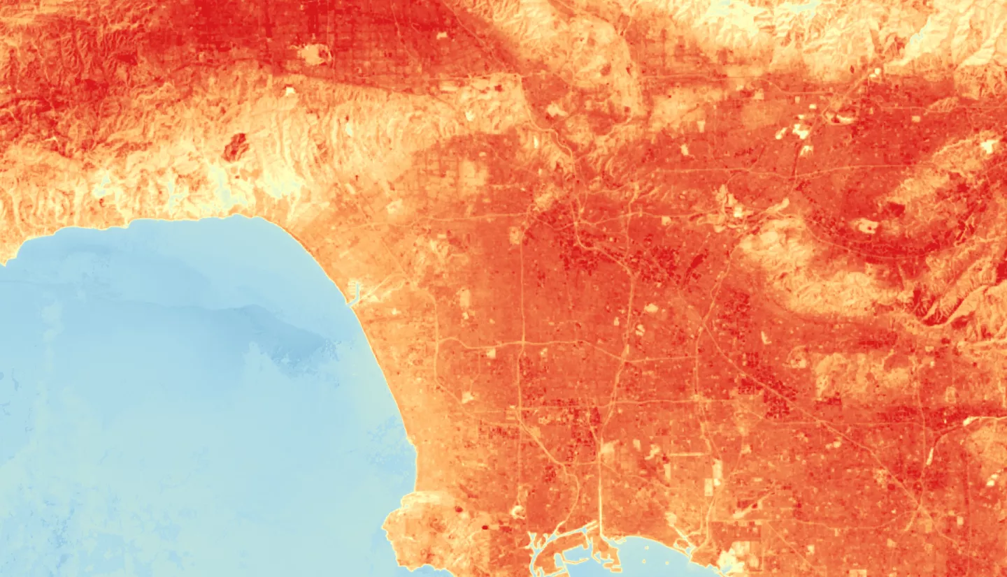
Summary: Over the last several decades the city of Los Angeles, California, has been experiencing increased temperatures resulting in the urban heat island effect. This is largely due to the expansion of developed areas which allow for the trapping of heat, posing dangerous health risks. As a solution, many organizations have turned to urban greening and tree planting initiatives to help cool vulnerable communities. NASA DEVELOP has partnered with City Plants and the City of Los Angeles, Office of Forest Management to study the role of trees in urban environments and their relation to the mitigation of local urban heat islands. This team used NASA Earth observations to obtain data spanning from 2016 to 2022, including land surface temperature and Normalized Difference Vegetation Index (NDVI) data collected from Landsat 8 Thermal Infrared Sensor (TIRS) and ISS ECOsystem Spaceborne Thermal Radiometer Experiment on Space Station (ECOSTRESS), respectively. Data from the National Agriculture Imagery Program (NAIP) were also used to obtain a supervised classification of tree canopy cover. Our analysis reveals a spatial and temporal connection between temperature and vegetation, suggesting that areas with more vegetation are less likely to suffer high summertime temperatures. Results also highlight the impacts of tree planting programs, such as the Vermont Corridor planting project, which increased tree canopy cover by up to 5% in the community between 2016 and 2022. These findings support the implementation of urban greening practices and inform residents and officials about how investing in trees will help mitigate increasing heat within Los Angeles.
Related Impact