WORKING TOGETHER AROUND THE WORLD
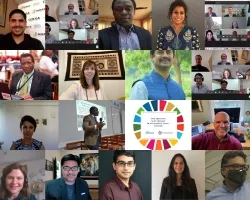
Applied Sciences is a community leader within the Group on Earth Observations (GEO). Our personnel and project teams actively lead and participate in the GEO Work Programme Activities, Regional Initiatives, Working Groups, and priority engagement areas. GEO is a unique global network connecting government institutions, academic and research institutions, data providers, businesses, engineers, scientists and experts to create innovation solutions to global challenges.
Jump to supporting NASA GEO Project(s):
Biodiversity and Ecosystem sustainability
group on earth observation biodiversity observation network (GEOBON)
GEOBON, a GEO Flagship, facilitates and brings together global biodiversity monitoring systems to understand global trends, the spread and retreat of invasive species and to inform policies for sustaining a biodiverse planet. NASA, NOAA, Navy and BOEM support the United States Marine Biodiversity Observation Network. NASA also supports eight projects spanning both terrestrial and marine ecosystems.
NASA GEO Projects supporting GEOBON
Earth Observation for Ecosystem Accounting (EO4EA)
EO4EA, a GEO Initiative, uses Earth observations to establish accounting systems for nature. NASA supports the Executive Secretary and two projects in Indonesia and National Ecosystem Accounts in the United States.
NASA GEO Projects supporting EO4EA
Disaster resilience
GEO Engagement Area - Sendai Framework for Disaster Risk Reduction
Global Flood Risk Monitoring
GFRM, a GEO community activity, assesses and translates flood risk information to impacts at the community, regional and national level. NASA supports three projects focused on improving global flood forecasts and compiling flash flood information.
NASA GEO Projects supporting GFRM
global wildfire Information system initiative (GWIS)
GWIS, GEO Initiative, is a tool supporting operational wildfire management from national to global scales. NASA is supporting three projects that are bringing new data and models to GWIS.
NASA GEO Projects supporting GWIS
Disaster risk reduction working group (DRR WG)
NASA is one of three DRR WG co-chairs. The WG is implementing a coherent and crosscutting approach within GEO to advance the use of EO to support national DRR and resilience efforts. The GEO Work Programme (GWP) is currently implementing more than two dozen activities using Earth observations for disaster preparedness and prevention, mitigation of potential damage, and better management of and recovery from disasters. The DRR-WG promotes awareness of relevant global policy frameworks, such as the United Nations Office for Disaster Risk Reduction (UNDRR) Sendai Framework for Disaster Risk Reduction 2015-2030, while serving as the primary GEO liaison to UNDRR.
Energy and Mineral Resource Management
GEO Vision for Energy (GEO-VENER)
GEO-VENER, a GEO Initiative, links the renewable energy community and the GEO Community on the use of Earth observation data in the development of renewable energies strategies. NASA supports two projects on capacity building and improved modeling.
NASA GEO Projects supporting GEO-VENER
Food Security and sustainable agriculture
GEOGLAM
NASA has been a leader in GEOGLAM spearheading its development, growth and political recognition. Work is done through NASA Harvest's support of 18 GEOGLAM projects, including moving the GLAM portal to the cloud.
NASA GEO Projects supporting GEOGLAMNASA Harvest GEOGLAM Projects
public health surveillance
GEO Health Community of Practice
The Health COP explores how environmental observations improve health decision-making at the international, regional, country and district levels. Co-chaired by NASA and NOAA, the COP hosts information-sharing teleconferences, e.g. Community Teleconferences and the Earth Observations and COVID-19: A Virtual Round the Room Update, to share research applications and activities that use Earth observations to advance knowledge on emerging environmental health risks including COVID-19 transmission. Five work groups offer additional opportunities to leverage expertise and share innovative data and technology to enhance community response efforts that protect population health.
GEO Earth Observations for Health (EO4Health)
EO4Health, a GEO Initiative, supports the systematic collection, analysis, and application of Earth observations to improve the capacity to predict, respond to, and reduce ecosystem risks to human health. NASA supports four projects: Myanmar Malaria Early Warning System; Environmental Determinants of Enteric Infectious Disease; Predictive Assessment of Transmission Conditions of Cholera; and Geospatial Surveillance and Response System Resource for Vector-borne Disease in the Americas.
NASA GEO Projects supporting EO4Health
sustainable urban development
Human-Planet
Human Planet, a GEO Initiative, is generating global-scale data and knowledge to advance our understanding of societal processes and their impact on Earth systems. NASA serves as a co-chair. A notable effort is the Atlas of the Human Planet 2020. NASA supports three projects including use of NASA’s Black Marble data, and mapping populations and settlements.
NASA GEO Projects Supporting Human Planet
Water resource management
GEO Global Water Sustainability (GEOGLOWS)
GEOGLOWS, a GEO Initiative, connects people with global water information. NASA supports four projects in Latin America, Mekong, Indus River Basin and India.
NASA GEO Projects supporting GEOGLOWS
GEO Engagement Area: United Nations 2030 Agenda for Sustainable Development
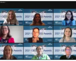
EO4SDG, a GEO Initiative, advances global knowledge about effective ways that Earth observations and geospatial information can be used to achieve the Sustainable Development Goals. NASA supports the Executive Secretary and one of the three Co-chairs. Notable achievements include: the Earth Observations Toolkit for Sustainable Cities and Human Settlements, in collaboration with the UN Human Settlements Program; and the GEO SDG Awards Program that recognizes productivity, innovation, novelty and exemplary efforts in the use of Earth observations to support sustainable development. NASA supports projects, capacity building and training.
Regional Initiatives
AmeriGEO includes the GEO members in the Caribbean, Central America, North America, and South America in five priority areas: Food Security and Sustainable Agriculture; Disaster Resilience; Water Resources Management; Biodiversity and Ecosystem Sustainability; and Public Health Surveillance. NASA, NOAA, and USGS provide assistance through leadership of the Americas Caucus, capacity building, and the AmeriGEO platform. Notable achievements include: the Inter-American Academy of Geosciences and Applications, and the data hub for access to maps, tools and applications. Annually, AmeriGEO Week bring communities together to identify the synergies for the integration of Earth Observations, geographic, statistical, and other information for better decisions and actions.
NASA supports four projects directly tied to AmeriGEO and another 14 in the region providing benefits to the AmerGEO community.
NASA GEO Projects Supporting AmeriGEO
SERVIR-Amazonia provides co-designed complementary services in drought and fire risk, ecosystem management, water and hydrology that bridge GEO and regional activities. It is also engaged with GEO initiatives such as GEOGLoWS and GEO’s Capacity Development Working Group.
AfriGEO links GEO activities and African countries and organizations to use Earth observations linking country, region, and continent. NASA supports six projects in the region in biodiversity, health, and disaster resilience and, through NASA Harvest and GEOGLAM, food security.
NASA GEO Projects in AfriGEO
SERVIR-Eastern and Southern Africa and SERVIR-West Africa provide co-designed complementary services in flood forecasting, flood relief, agriculture and food security; water resources and hydroclimatic disasters; weather and climate; and land cover, land use change and ecosystems. The SERVIR hubs also have linkages with GEO Flagships and initiatives such as GEOGLAM, GFOI, and Digital Earth Africa.
AOGEO brings together the GEO community in Asia-Oceania to exchange scientific and technical views on Earth observations and their applications for regional and global priorities. NASA supports nine projects in the areas of health, ecosystems, water management, wildfires and human planet. They are also engaged with GEO Flagships and initiatives such as GEOGLAM, GFOI, GEOGLoWS, and GEO-DARMA, among others.
NASA GEO Projects in the AOGEO
SERVIR-Hindu Kush Himalaya and SERVIR-Mekong provides co-designed complementary services in Climate Resilience and Food and Water Security that bridge GEO and regional activities.
Capacity Development Working Group (CD-WG)
NASA is one of two CD-WG co-chairs. The CD-WG has compiled capacity building resources including webinars, trainings and best practices guides.
GEO Indigenous Alliance
NASA and Conservation International co-led the GEO 2019 Side Event: EO and the World's Indigenous Peoples, an enabling step in the formation of the GEO Indigenous Alliance. NASA works with US tribal members to support the GEO Indigenous Alliance which held the GEO Indigenous Summit 2020. NASA supports one project on Indigenous Peoples.
GEOValue
GEOValue is an international community of interdisciplinary scientists focused on elevating the understanding of the benefits and impacts of Earth observations, along with the various methods used to understand and measure these benefits. GEOValue participates under the Group on Earth Observations (GEO), which is a global coordinating body that aims to enhance the use of Earth observations in environmental decision-making across sectors and borders. Activities include fostering collaboration across specialties and building communication and trust across social, economic, and natural sciences; compiling a structured inventory and repository of use cases and analysis methodologies; and organizing international events, conference sessions, and webinars to address methodologies, use cases, and applications.

