Displaying 1 - 6 of 6
![NDVI-processed imagery using Landsat 8 OLI data from June 1 to November 31, 2021. Showing Punakha, Bhutan, vegetative areas are represented by green while black depicts non-vegetative areas. Bhutan is located in the Himalayas with altitude ranging from 550 ft. to 23,000 ft., resulting in vast diversity of both ecosystem and agricultural products. Examining vegetation area help in developing a crop mask and remotely sensed data collection protocol for rice in Bhutan.](/sites/default/files/styles/lis/public/2022-03/2021Fall_MSFC_BhutanAg_WebsiteImage.png.webp?itok=z2epU4rN)
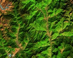
Bhutan Agriculture (Fall 2021) Team: Yeshey Seldon (Project Lead), Kusal Khandal, Sherab Dolma, and Wangdrak Dorji Summary: Rice cultivation in Bhutan has been increasingly threatened...
![Processed MOD13Q1.006 Terra Vegetation Indices 16-Day Global 250m imagery and calculated 20-year median NDVI for serial 16-day MODIS composites (January 1st, 2000, to December 31st, 2020), reflected for the Tonlé Sap Lake region, within Cambodia SE Asia. High photosynthetic capacity is dark green, low photosynthetic capacity is tan, water detected in NDVI is white. Focusing on low to high vegetation cover, density, and productivity to prioritize resource allocation and increase agricultural sustainability f](/sites/default/files/styles/lis/public/2022-05/2021Fall_LaRC_TonleSapAgIII_WebsiteImage.png.webp?itok=lKxy2FVf)
Tonle Sap Food Security & Agriculture III (Fall 2021) Team: Joey Lindsay (Project Lead), Keida Gaba, Lindsay Harmon, Susan Jarvis Summary: Tonlé Sap Lake, located...
![False-color imagery from Landsat 8 surface reflectance. The 2021 median composite image depicts the landscape and vegetation sites in the regions of western Bhutan, specifically the districts of Punakha, Wangdue Phodrang, Thimphu, and Paro. The band combination highlights fallow agriculture fields in light brown, dense urban areas in purple, forest cover in green, snow in light blue, and rocky areas in darker brown.](/sites/default/files/styles/lis/public/2022-12/2022Sum_MSFC_BhutanAgII_WebsiteImage.png.webp?itok=T2Ky1XPH)
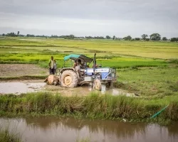
Bhutan Agriculture II (Summer 2022) Team: Wangdrak Dorji (Project Co-Lead), Tenzin Wangmo (Project Co-Lead), Karma Dorjee, Sonam S Tshering Summary: Agriculture is an essential sector...
![NDVI processed imagery from Landsat 9 Collection 2 Tier 1 TOA Reflectance for the whole year of 2022. The composite image shows the vegetation landscape of western Bhutan, focused on the districts of Punakha, Paro, and Wandgue Phodrang. The band combinations highlight forest cover in green, paddy fields in light brown, waterbodies in gray, and barren lands and settlements in black.](/sites/default/files/styles/lis/public/2024-01/2023Sum_MSFC_BhutanAgIII_WebsiteImage.jpg.webp?itok=DlIoUvUN)
Topic
Bhutan Agriculture III (Summer 2023) Team: Sonam Seldon Tshering (Project Lead), Garab Kuenphen Dorji, Ugyen Thinley Dorji, Sangay Choden, Tenzin Lhaden Summary: The Bhutan Agriculture...