Bhutan Agriculture (Fall 2021)
Team: Yeshey Seldon (Project Lead), Kusal Khandal, Sherab Dolma, and Wangdrak Dorji
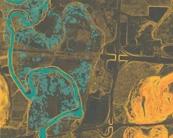
Summary: Rice cultivation in Bhutan has been increasingly threatened by deteriorating soil health and outbreaks of diseases and pests associated with the global change in climate patterns. Field surveys, which the national government of Bhutan has relied on to monitor remote agricultural lands, are becoming increasingly overwhelmed by growing threats to agricultural health. To address these concerns, NASA DEVELOP partnered with the Department of Agriculture of Bhutan, the Bhutan Foundation, and the Ugyen Wangchuck Institute of Conservation and Environmental Research (UWICER) and worked to increase the government of Bhutan’s agricultural monitoring capacity. Utilizing Earth observations including Landsat 8 Operational Land Imager (OLI), Sentinel-1 C-band Synthetic Aperture Radar (C-SAR), Shuttle Radar Topography Mission (SRTM), and Planet imagery, the DEVELOP team worked with NASA SERVIR and created a sampling protocol to identify rice plantations and supplement field surveys for more efficient agriculture monitoring. The analysis focused on districts Paro, Punakha, Samtse, Sarpang, Trongsa, Zhemgang, Wangdue Phodrang, and Samdrup Jongkhar in the year 2020 during the period of transplantation (June) to harvesting of rice (November). The team provided the partners with a sampling protocol for integrating NASA Earth observations into their crop monitoring methods, as well as a crop mask for rice identification and to aid crop management. The crop mask for rice was developed using the Random Forest (RF) classifier for the eight districts of Bhutan. Visually, the random forest model has proved to be more accurate and precise than the classification and Regression Tree model. Statistically, the Random Forest model was 91.8% accurate in identifying rice in Bhutan.
Related Impact