Displaying 21 - 28 of 28
![NDVI over Mato Grosso, Brazil processed from March 2021 Landsat-8 OLI data. Calculated NDVI values correspond with colors shown to indicate plant health. High NDVI values (green to blue) indicate dense vegetation found in tropical and temperate forests or crops at their peak growth. Low values (yellow to red) depict barren land, water, and moisture-stressed vegetation. These data can support timely and efficient agricultural responses to ensure productive yields and food security.](/sites/default/files/styles/lis/public/2022-12/2022Sum_NC_MatoGrosso_WebsiteImage_FD.png.webp?itok=JJA3kKJi)
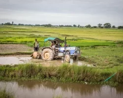
Mato Grosso Agriculture (Summer 2022) Team: Max Rock (Project Lead), Elijah Dalton, Aidan Harvey, Kate Reynolds Summary: Ranked as the fourth largest food producer in...
Affiliation
NASA Marshall Space Flight Center
Program Role
Associate Program Manager, Water Resources and Agriculture
Christopher Hain is an Associate Program Manager in the Water Resources and Agriculture Application Areas.
Affiliation
NASA Headquarters
Program Role
Program Coordinator, Agriculture
Cordelia Hiers Brady is the Program Coordinator for NASA’s Applied Sciences agriculture application area.
![Annual max biomass calculated from 2021 daily Harmonized LandSat Sentinel-2 (HLS) dataset. Dark purple colors show low biomass while the bright orange show high biomass. Regions with high vegetation and tree canopy cover are shown in orange on the left of the image. High biomass values are of an interest to rangeland managers to help inform their grazing decisions based on which areas of the ranch produce the most biomass/vegetation.](/sites/default/files/styles/lis/public/2023-02/2022Fall_CO_EasternPlainsAgr_WebsiteImage.jpg.webp?itok=StO3rYYa)
Eastern Plains Agriculture (Fall 2022) Team: Jillian Joubert, Sarah Hettema, Deni Ranguelova, TR Ingram, Max Stewart Summary: Adaptive management on cattle ranches requires rangeland managers...
![A Landsat 8 Operational Land Imager image of North Carolina on July 14, 2017 that shows agricultural fields](/sites/default/files/styles/lis/public/2023-08/trenton_oli_2017195_lrg.jpg.webp?itok=9VRRxCaE)
Landscape Analysis of African American farmers in North Carolina and approaches for applying NASA’s data to help prevent their extinction Team: Kibri Everett, PhD (RTI...
Applied Sciences
Capacity Building
Disasters
Agriculture
![Taro (kalo) field in Maui.](/sites/default/files/styles/lis/public/2023-10/Kerner%20Project%20Page%20Image.png.webp?itok=6utRYQZY)
EO-Enabled Food Security Dashboard to Close Critical Data Gaps in Highly Food Insecure Maui County Team: Hannah Kerner (Arizona State University), Catherine Nakalembe (University of...