Displaying 141 - 150 of 305
Topic
The gopher frog (Lithobates capito) is an endangered species facing extinction within the next century due to loss and alteration of its habitat. With limited...
Topic
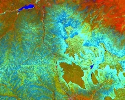
Fisher’s Peak is a 77.5 km2 property southeast of Trinidad, Colorado that is planned to become Colorado’s newest state park. The area has experienced limited...
Topic
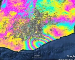
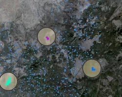
When an earthquake occurs, seismic data provides an initial estimate of magnitude and location. However, for large earthquakes, we can improve our situational awareness once...
Topic
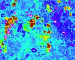
Nearly a quarter of California's fresh water supply flows through the Sacramento-San Joaquin Delta, an area comprised of tidal marshland and reclaimed land in the...
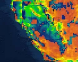
Topic
California’s Central Valley is one of the most productive agricultural areas in the world, producing approximately $20 billion in crops annually. The recent California droughts...
Topic
Principal Investigator: Miguel Villarreal, USGS Western Geographic Science Center (mvillarreal@usgs.gov) Co-Investigator: Brian Ebel, USGS Water Mission Area-Earth System Processes Division (bebel@usgs.gov) Wildfires increase flood and...
Topic
Due to increasingly frequent and severe drought conditions in the southwestern US, land managers and livestock producers need to monitor stock ponds with increasing regularity...
Topic
Project Description: The goal of this work is to improve the quality and usefulness of groundwater models by incorporating information derived from interferometric synthetic aperture...