On June 23rd, 2020 a magnitude 7.4 earthquake occurred near Oaxaca, Mexico, damaging buildings and prompting evacuations in the region. The earthquake also triggered a tsunami warning, with waves of 0.68 meters (2.2 ft) observed in Acapulco and 0.71 meters (2.3 ft) in Salina Cruz.
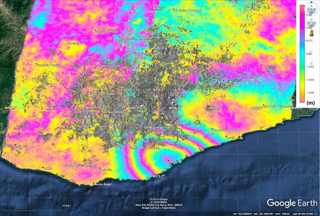
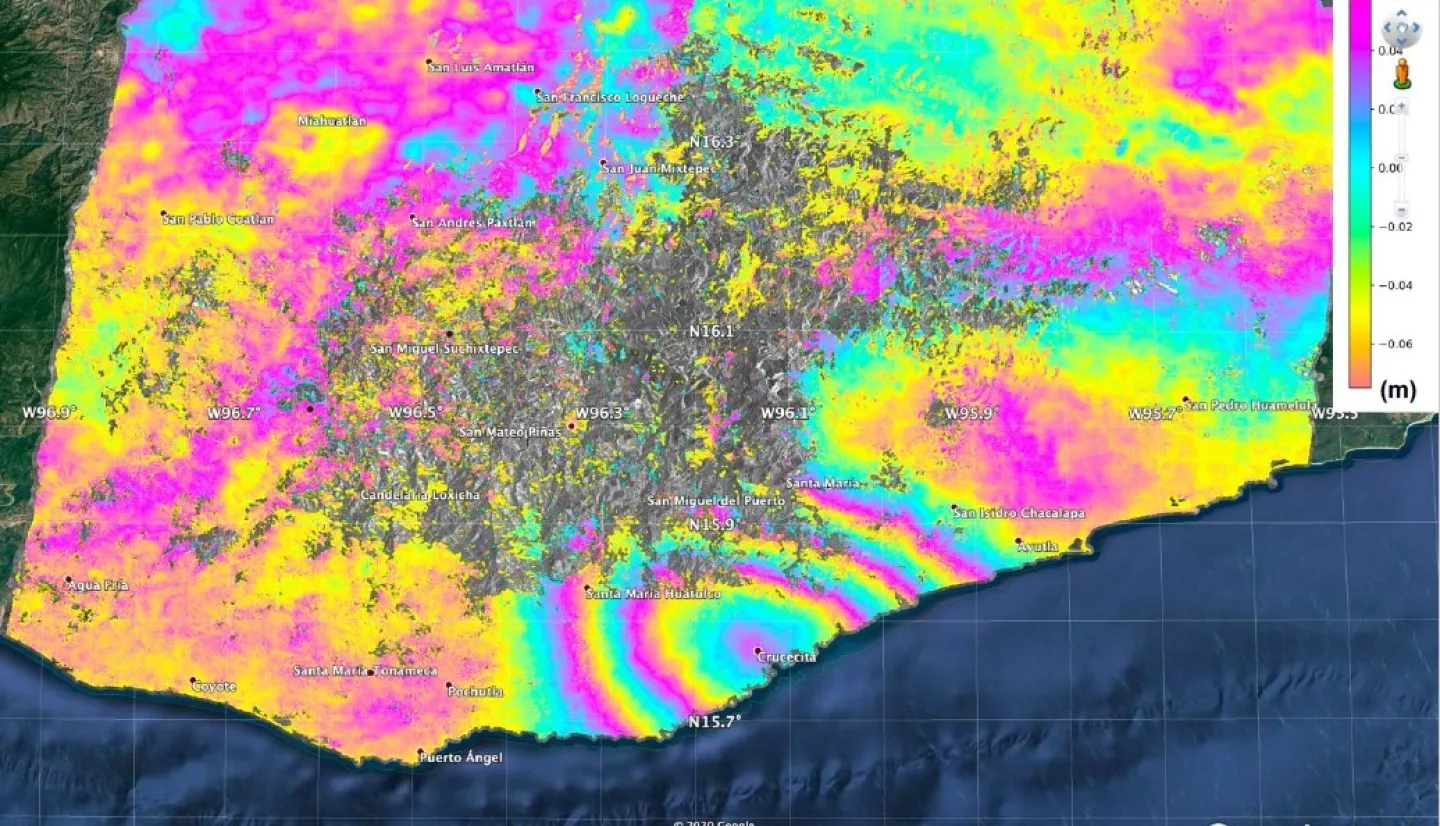
The NASA Earth Applied Sciences Disasters Program has activated for this event for research purposes, and is coordinating with researchers and partners to produce satellite-based data and imagery to better understand the event and its impacts. To date, surface displacement maps (see above) have been generated using Japan Aerospace Exploration Agency (JAXA) ALOS-2 satellite Synthetic Aperture Radar (SAR) data of the region.
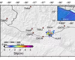
The NASA Applied Sciences A.37 ROSES research project “Enlisting Satellite Data to Modernize Local Tsunami Early Warning”, lead by Dr. Diego Melgar, has generated slip models and tsunami models for the event using Global Navigation Satellite System (GNSS) displacement data. Although the tsunami impacts from the event were minor, this was an opportunity to test the capabilities of the tsunami forecasting and early warning system, which will help to guide modifications in the software and familiarize practitioners with the strengths and limitations of the different methods used. Using lessons learned from these and other events, the project will work towards producing an operational GNSS-enabled tsunami early warning system which will provide actionable information to emergency responders and decision makers to order evacuations in the affected regions as quickly as possible.