The Advanced Rapid Imaging and Analysis (ARIA) team at NASA's Jet Propulsion Laboratory in Pasadena, California, and Caltech, also in Pasadena, created this Damage Proxy Map (DPM) depicting areas around Fuego volcano, Guatemala, that are likely damaged (shown by red and yellow pixels) as a result of pyroclastic flows and heavy ash spewed by Fuego volcano. The map is derived from synthetic aperture radar (SAR) images from the Copernicus Sentinel-1 satellites, operated by the European Space Agency (ESA). The images were taken before (June 1, 2018 6PM) and after (June 7, 2018 6PM, both Guatemala Time) the onset of the volcanic eruption.
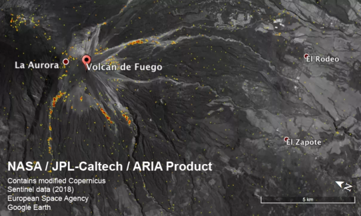
The map covers an area of 57 by 13 miles (91 by 21 kilometers), shown by the large red polygon. Each pixel measures about 33 yards (30 meters) across. The color variation from yellow to red indicates increasingly more significant ground surface change. This damage proxy map may be used as guidance to identify damaged areas and may be less reliable over vegetated areas. For example, the scattered single colored pixels over vegetated areas may be false positives, and the lack of colored pixels over vegetated areas does not necessarily mean no damage.


