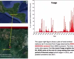
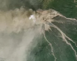
On Sunday, June 3rd, Guatemala’s Fuego Volcano erupted violently and with little warning, sending ash nearly four miles into the air, and burying villages under an avalanche-like pyroclastic flow of superheated ash and volcanic gasses. At least 62 fatalities have been reported thus for, with hundreds more missing and injured. The death toll is expected to climb, and the country’s disaster agency said that over 3,200 people had been evacuated. As of June 5th, eruptions have continued as evacuation orders remain in effect.
Learn more: http://www.ssd.noaa.gov/VAAC/washington.html
January 31st, 2018:
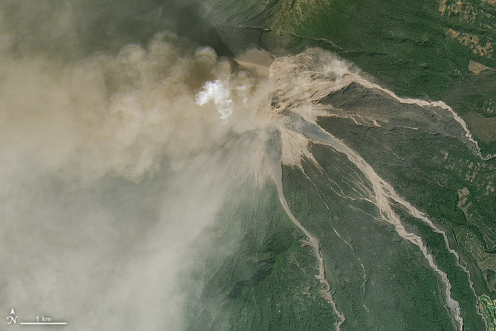
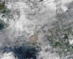
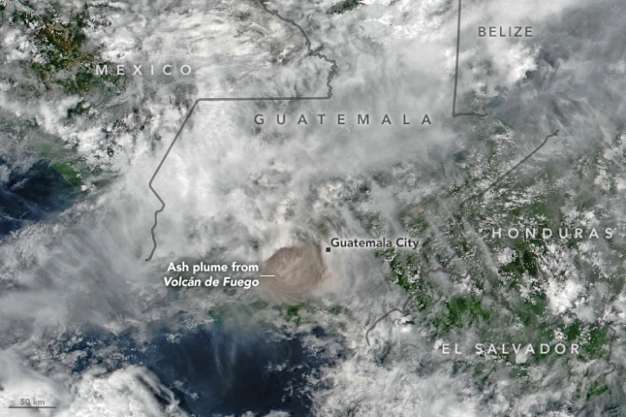
Mt. Fuego in Guetemala has erupted on January 31st 2018. According to the Coordinadora Nacional para la Reducción de Desastres (CONRED), the plume reached an altitude of 6,500 meters (21,300) feet above sea level and was carried 40 kilometers (25 miles) to the west and southwest by the winds. Falling ash affected tens of thousands of people, primarily in the provinces of Escuintla and Chimaltenango. Lava from two active conduits flowed through four ravines, leading officials to preemptively close National Route 14 to vehicles.
Related Impact