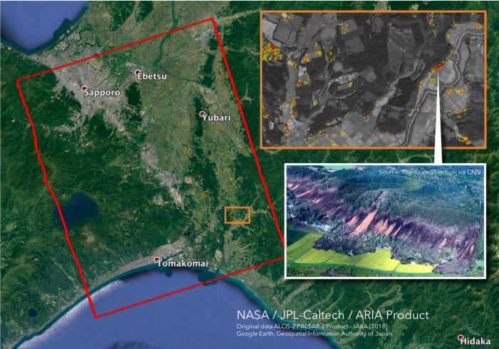
The Advanced Rapid Imaging and Analysis (ARIA) team at NASA's Jet Propulsion Laboratory in Pasadena, California, and Caltech created a Damage Proxy Map (DPM) depicting areas in the southwestern part of Hokkaido, Japan, that are likely damaged (shown in red and yellow pixels) as a result of the earthquake on September 5, 2018. The map is derived from synthetic aperture radar (SAR) images from the Advanced Land Observing Satellite (ALOS-2), operated by the Japan Aerospace Exploration Agency (JAXA). The images were taken before the earthquake on August 23, 2018 and after the earthquake on September 6, 2018. The map covers an area of 70 by 57 kilometers, shown by the large red polygon. Each pixel measures about 30 meters across. The color variation from yellow to red indicates increasingly more significant ground surface change. Preliminary validation was done by comparing with the high-resolution airborne optical imagery provided by the Geospatial Information Authority of Japan. This damage proxy map can be used as guidance to identify damaged areas.
For more information about ARIA, visit: http://aria.jpl.nasa.gov


