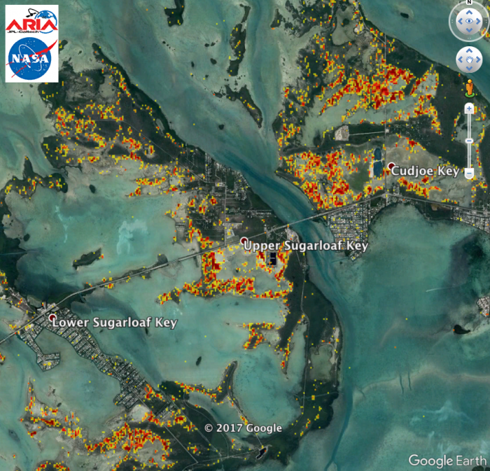
The Advanced Rapid Imaging and Analysis (ARIA) team at NASA's Jet Propulsion Laboratory in Pasadena, California, created this Damage Proxy Map (DPM) depicting areas of Southwestern Florida, including Key West and Naples, that are likely damaged as a result of Hurricane Irma (Category 4 at landfall in Florida), shown by red and yellow pixels. The map is derived from synthetic aperture radar (SAR) images from the European Space Agency's (ESA) Sentinel-1 satellite, taken before (August 29, 2017) and after (September 10, 2017) Hurricane Irma made landfall. The map covers an area of 53 miles x 118 miles (85 km x 190 km). Each pixel measures about 33 yards x 33 yards (30 m x 30 m). The color variation from yellow to red indicates increasingly more significant ground surface change. Preliminary validation was done by comparing to optical satellite imagery by the DigitalGlobe. This damage proxy map should be used as guidance to identify damaged areas, and may be less reliable over vegetated areas. Sentinel-1 data were accessed through the Copernicus Open Access Hub. Contains modified Copernicus Sentinel data 2017.


