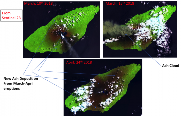
Multiple eruptions from the locally named “Manaro” volcano on the Ambae (Aoba) Island in Vanuatu have led the evacuations of thousands of people affected by the disposition of thick volcanic ash layers on the Ground leading to widespread destructions of Farm lands. Satellite imageries from ESA/Sentinel 2B using wavelength bands sensitive to monitor crops show the extension of the devastation since March, 10th. The quasi-continous eruptions (see ash plume, image on March, 15th) have led to new larger dark patches of ash in the Northern, Eastern and Southern Parts of the Island (see image on April,24th). More than 70% of the island seems to be recovered by volcanic ash as shown by a satellite image a few days ago (April, 24th). The island has become quasi inhabitable and thousands of people are now searching to new places to live.


