Published
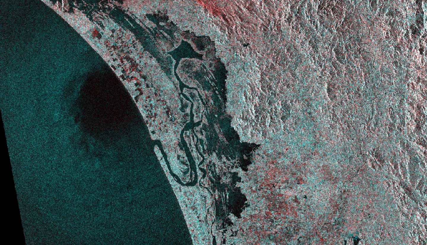
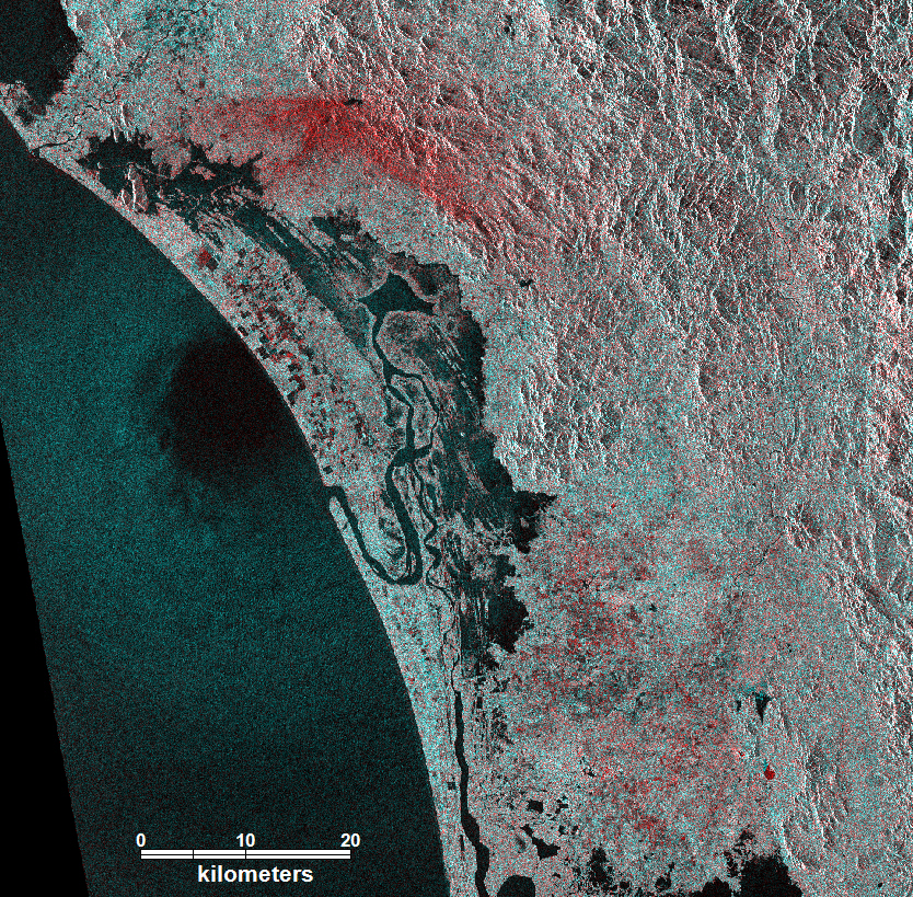
The European Space Agency (ESA) Sentinel-1 Synthetic Aperture Radar (SAR) captured the moment of landfall of the eye of Hurricane Willa on October 24, 2018. The red areas to the north may represent very heavy precipitation ("pluvial" flooding). Brighter wind-driven waves surround the calmer, darker water below the eye. Part of the eye has come ashore. It is not yet known if this image also shows the storm surge. Many small red areas represent locally flooded ground. Image processing was performed at the Dartmouth Flood Observatory, University of Colorado, with funding support from the NASA Applied Sciences Program. This image contains modified Copernicus Sentinel data [2018], processed by ESA.
1060


