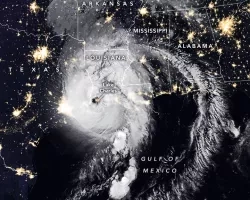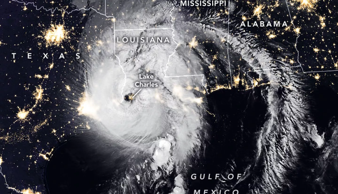
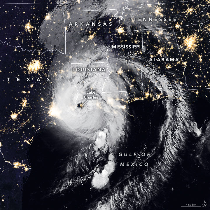
Early in the morning on Aug. 27, Hurricane Laura made landfall along the Louisiana and Texas coastline, bringing 150 m.p.h. winds, flash floods and heavy rainfall with it. On the ground, emergency personnel mobilized to respond to the Category 4 storm. But for NASA’s fleet of Earth-observing satellites, it was business as usual.
Those satellites – as well as several from NASA’s international partner space agencies – constantly orbit Earth, using sophisticated sensors to collect data about what’s going on down below. When Hurricane Laura hit, NASA already had eyes on the storm.
“We use that cutting-edge NASA science to address disasters,” said Lori Schultz, a remote-sensing scientist with the University of Alabama who is leading NASA’s efforts on this storm for the NASA Earth Applied Sciences Disasters program area. The program seeks to provide disaster response and management personnel with relevant, up-to-date information to help communities prepare for disasters and manage recovery efforts.
“Basically, we ask: can we answer a question that needs to be answered?” said Schultz. Because of NASA’s abundance of remote-sensing data and partnerships with other space agencies around the globe, NASA is in a unique position to get a broader view of the storm’s impacts than what first responders can see from the ground. “Sometimes we can answer questions that nobody else can,” Schultz said.
Schultz and the rest of the NASA Disasters team are busy processing and analyzing the data collected by satellites passing over Hurricane Laura before, during, and after it makes landfall. They’re using data collected by the NASA-U.S. Geological Survey Landsat satellites, the NASA-JAXA Global Precipitation Measurement satellite that peers through the clouds to observe rain rates, the European Space Agency’s Sentinel 1 and 2, and others to create flood maps, assess coastal erosion and pinpoint damaged areas.
Read the full story at: https://www.nasa.gov/feature/esnt/2020/eyes-on-the-storm-nasa-aids-disaster-response-to-hurricane-laura