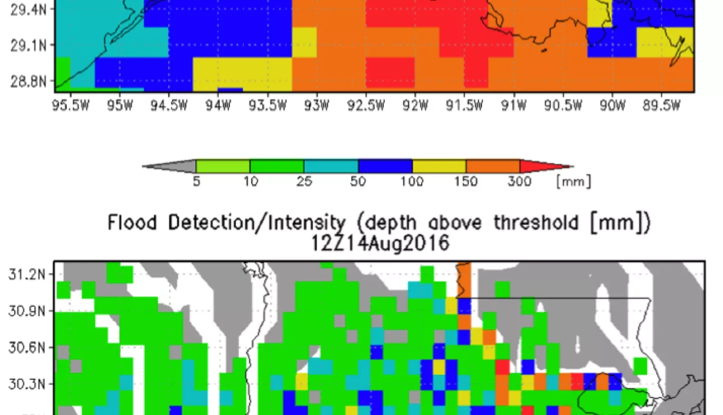
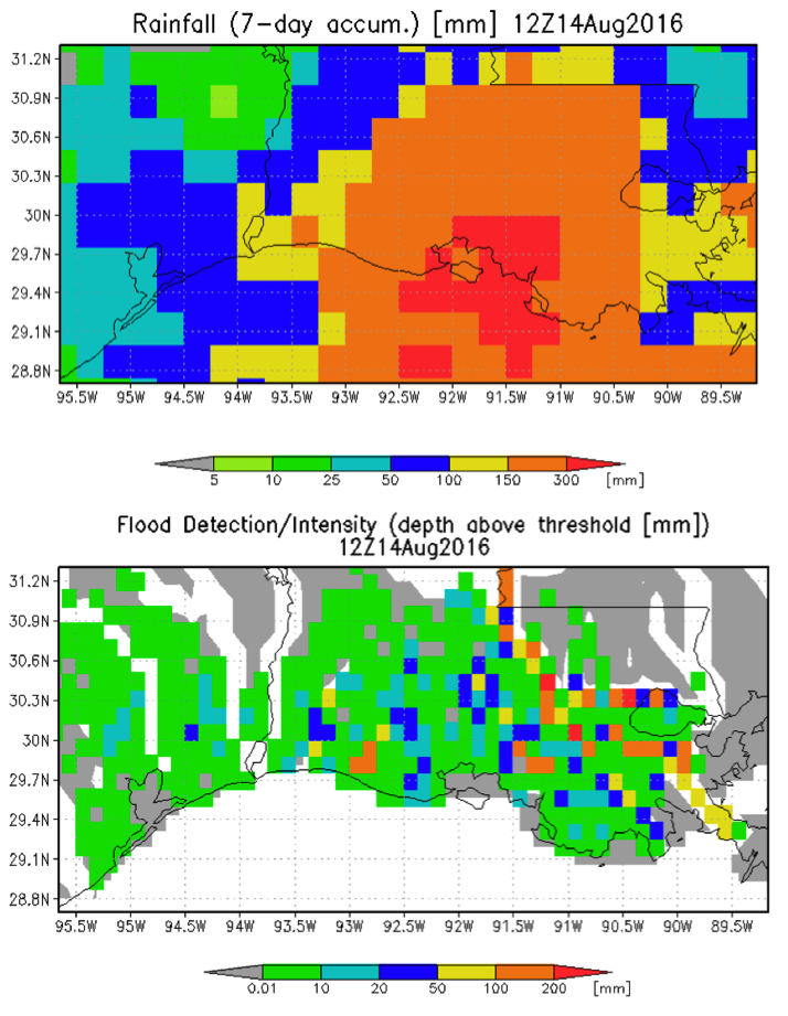
Heavy rain from a tropical system—over 300mm in the last week, with most of that coming in the last three days has caused heavy flooding in Louisiana. The Global Flood Monitoring System (GFMS) has been used to analyze the event in real-time. These slides summarize the results. The images in this slide show the rainfall amounts as of Sunday (14 August) and the pattern of floods at the 12 km resolution. The following images show the pattern of evolution during the last few days and the forecast for the next few days.
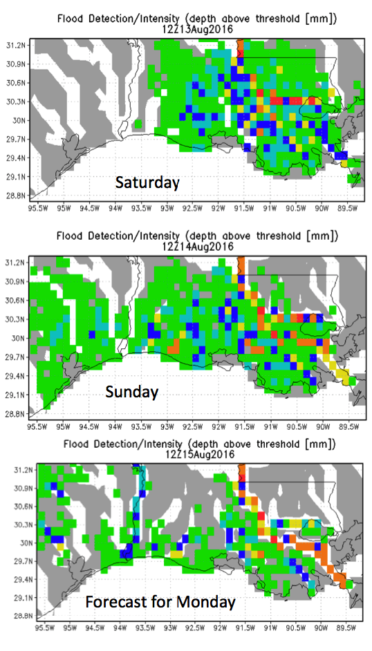
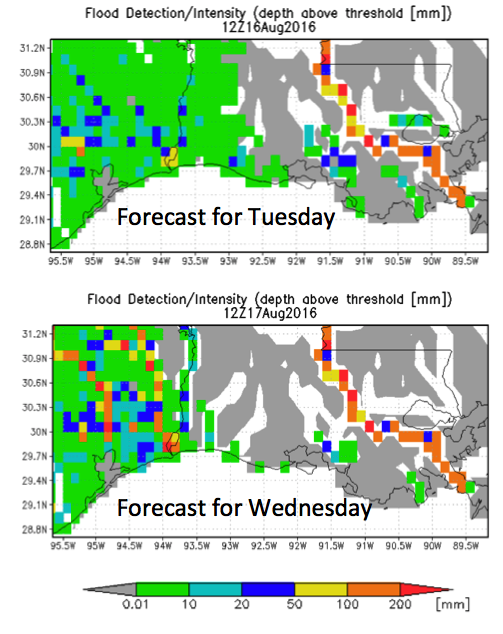
Evolution and Forecast of Flood
Once a day snapshots starting Saturday show floods first flooding in eastern portion of the state moving more to the southwest lat Saturday and Sunday. Forecast indicates flood effect lessening, but still significant on Monday , with a continued shift westward into Texas by Wednesday.