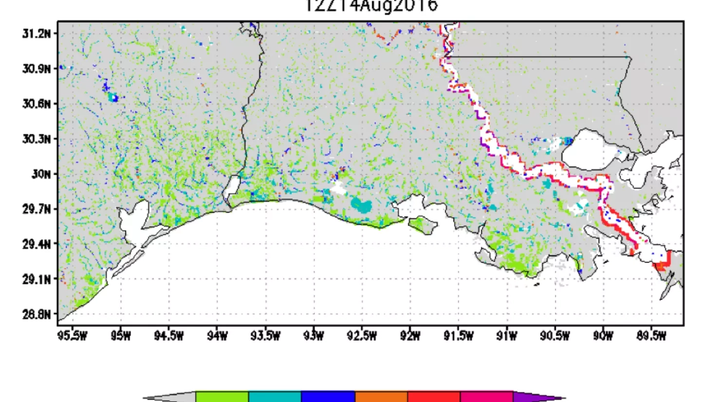
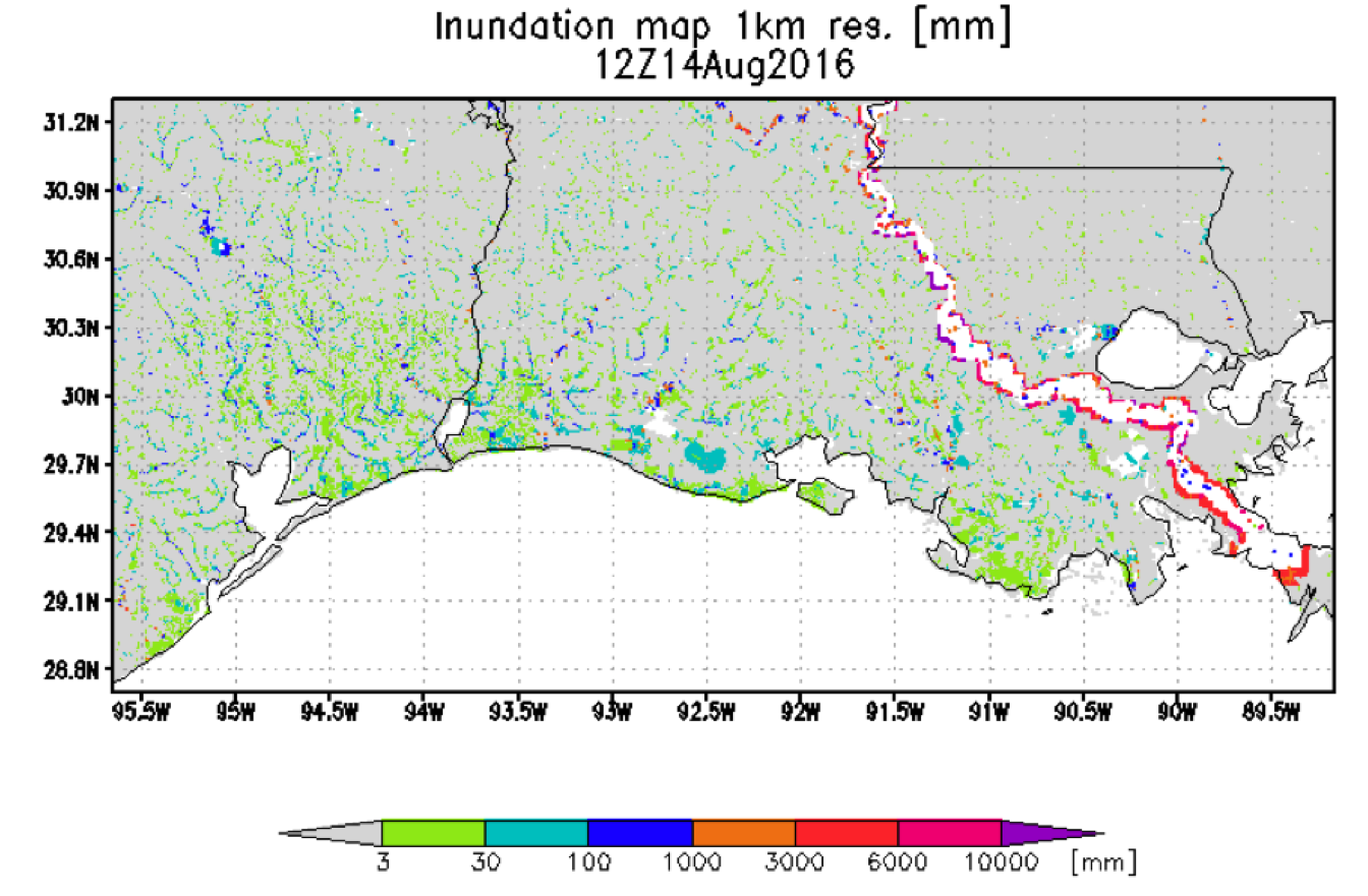
Routing and inundation calculations at 1 km resolution give a more detailed estimate for flooding location and depth. Results for today show flooding along Mississippi (although protected by levees, etc.) and areas of flooding in southwest LA and into Texas.
Streamflow and Inundation at 1 km Resolution
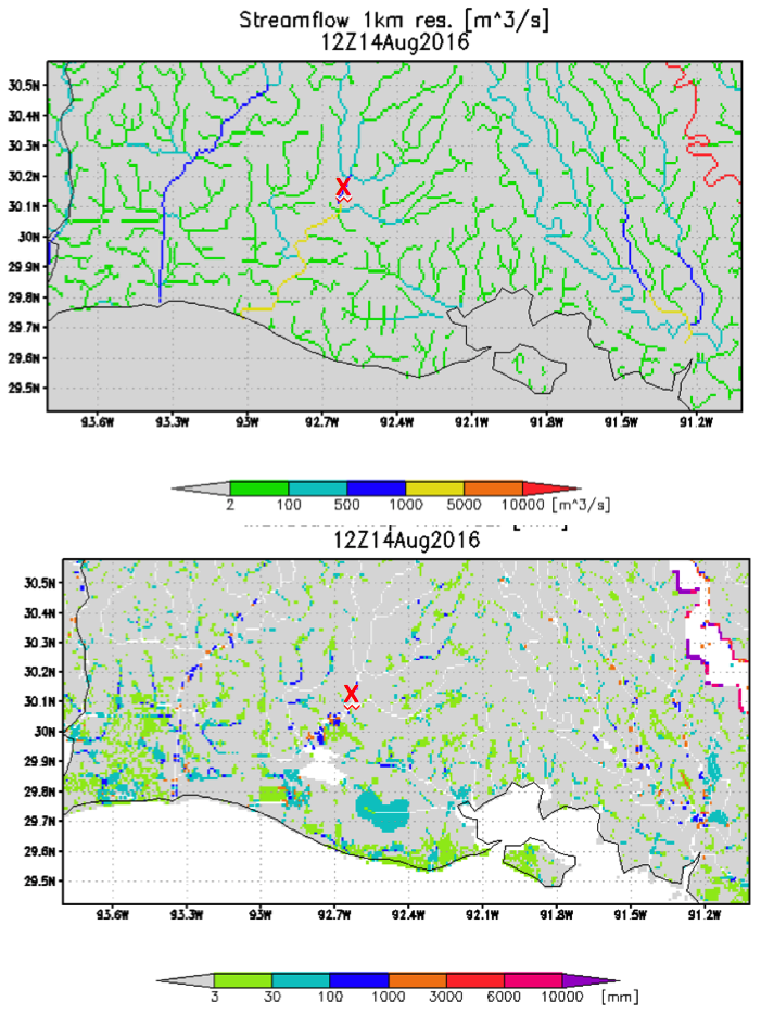
Maps of streamflow and inundation allow finer diagnosis of locations of high streamflow and flooding. In this expansion of map from previous slide areas most affected can be estimated. In these figures “x” marks the location of Mermentau, LA along the Mermentau River, which has a streamgauge to compare with the GFMS estimate—next slide
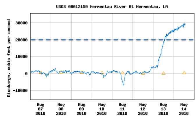
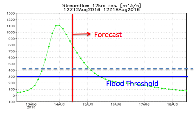
Streamflow Comparison
Streamflow comparison at Mermentau LA (30.19N, 92.59W) indicates GFMS correctly identified rapid rise on Saturday, reached peaks roughly equivalent as observed, but started to decrease in magnitude too early. Forecast streamflow from GFMS continues to show rapid decrease over next several days. Success validated at a few locations allows for use of GFMS at any grid location of interest.