Intensifying hurricane Marie is on a path that is predicted to impact the Leeward Islands. Hurricane Irma caused death and wide spread destruction there less than two weeks ago. Very powerful convective storms and multiple lightning strokes within Maria have been cited as proof that Maria is an energetic intensifying hurricane.
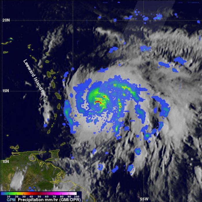
The GPM core observatory satellite had an excellent view of hurricane Maria when it passed almost directly above the hurricane on September 17, 2017 at 1001 PM AST (September 18, 2017 0201 UTC). GPM's Microwave Imager (GMI) and Dual-Frequency Precipitation Radar (DPR) showed that Maria had well defined bands of precipitation rotating around the eye of the tropical cyclone. GPM's radar (DPR Ku band) found rain falling at a rate of over 6.44 inches (163.7 mm) per hour in one of these extremely powerful storms northeast of Maria's eye.
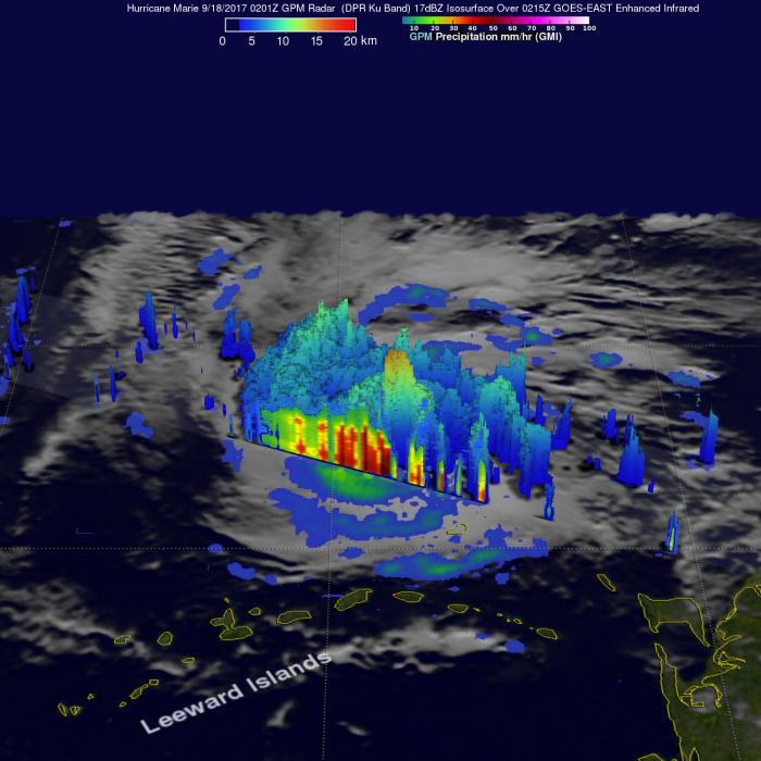
A 3-D view of Maria's precipitation structure was accomplished using data from GPM's Radar (DPR Ku band). Intense thunderstorms were found towering to above 9.7 miles (15.7 km). This kind of chimney cloud, also called a "hot tower" (as it releases a huge quantity of latent heat by condensation). These tall thunderstorms in the eye wall are often a sign that a tropical cyclone is becoming more powerful.


