
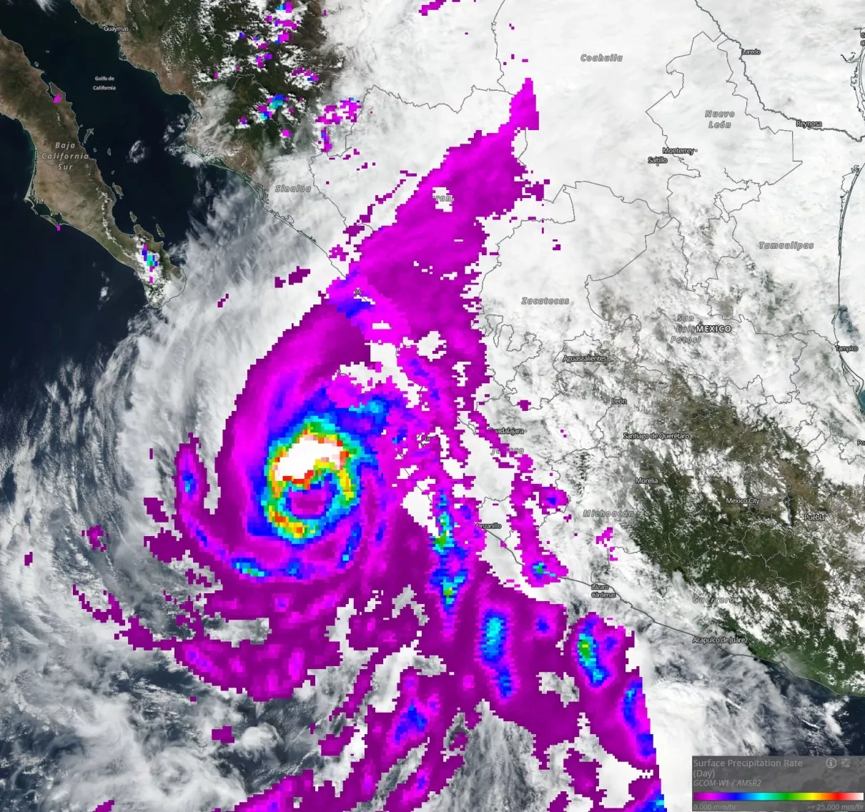
On October 22, 2018 the Advanced Microwave Scanning Radiometer 2 (AMSR2) instrument, onboard Japanese Aerospace Exploration Agency (JAXA)’s Global Change Observation Mission (GCOM)-W1 satellite, observed the surface precipitation rates of Hurricane Willa as it approached Mexico. This Land, Atmosphere Near-Real Time Capability for EOS (LANCE) NRT AMSR2 image shows high precipitation rates in red, yellow and light blue and lower precipitation rates in dark blue and purple. LANCE NRT AMSR2 products include surface precipitation rate, wind speed over ocean, water vapor over ocean and cloud liquid water over ocean. NRT AMSR2 products are generated within three hours of observation, using algorithms provided by the NASA-funded US AMSR2 Science Team, with JAXA NRT L1R as input.
Discover and access LANCE AMSR2 NRT data:
https://lance.nsstc.nasa.gov/amsr2/data.html
View AMSR2 image using the NASA Worldview website:
https://go.nasa.gov/2SeRRYO
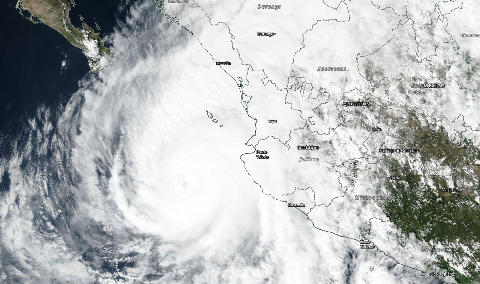
On October 22, 2018 the Visible Infrared Imaging Radiometer Suite (VIIRS) instrument aboard Suomi-NPP and Moderate Resolution Imaging Spectroradiometer (MODIS) instrument aboard the Terra and Aqua satellites both observed Hurricane Willa. The VIIRS and MODIS images revealed the cloud-filled eye.
Discover and Access LANCE VIIRS and MODIS NRT data:
https://earthdata.nasa.gov/earth-observation-data/near-real-time
View VIIRS and MODIS image using the NASA Worldview website:
https://go.nasa.gov/2SjEneA


