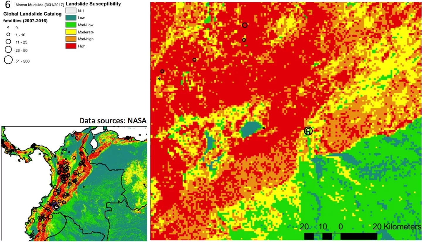
Torrential rains on the night of Friday March 31st 2017 caused three rivers surrounding the southern Colombian city of Mocoa to overflow -- sending a torrent of mud and debris surging through the city. At least 254 people were killed.
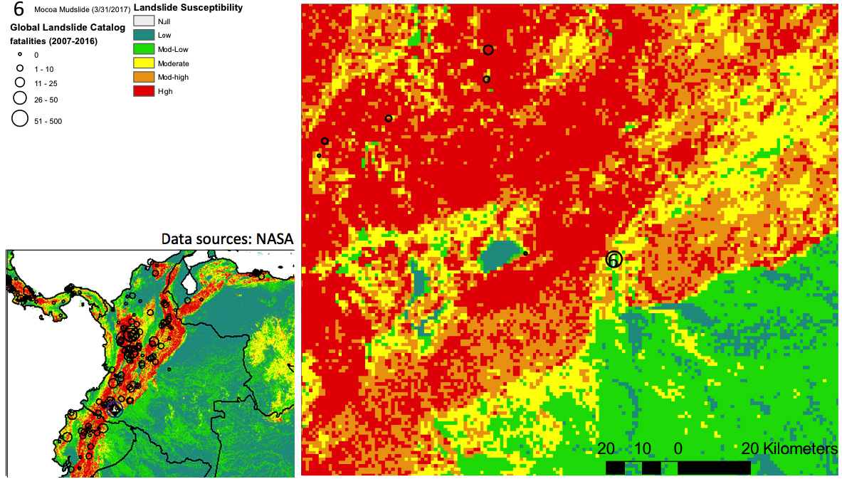
The above image shows the Global Landslide Susceptibility map for the affected region, overlaid with the estimated total fatalities due to landslides from 2007-2016 on the left. This data was generated as part of NASA's Global Landslide Catalog project. Learn more and view the full Global Landslide Susceptibility map here: https://pmm.nasa.gov/applications/global-landslide-model
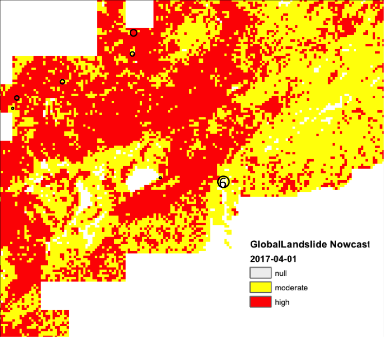
This image shows the near-realtime Landslide Nowcast product for the Macao Columia region for 4/1/2017. View more landslide nowcasts and other near-realtime precipitation products using the NASA Precipitation and Applications Viewer: https://pmm.nasa.gov/precip-apps


