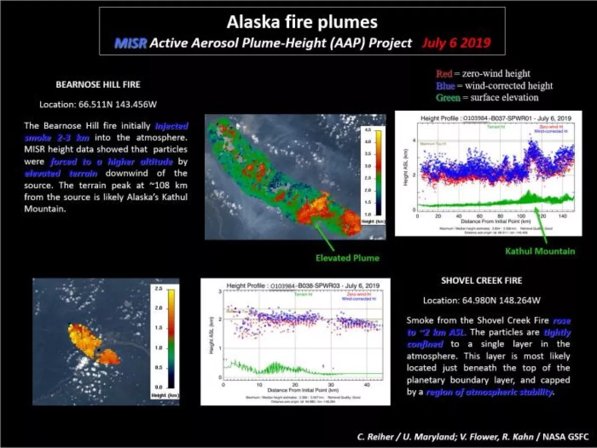
These images compiled by NASA’s Multi-angle Imaging SpectroRadiometer (MISR) Active Aerosol Plume-Height Project illustrate smoke heights from the Bearnose Hill and Shovel Creek fires in Alaska on July 6. MISR’s stereo texture and color images enable accurate mapping of wildfire smoke-plume heights, distinguishing smoke plumes from clouds based on detected particle properties.
On July 6 and 8, MISR observed multiple fire plumes emanating from a wildfire outbreak across Alaska. Imagery from the Moderate Resolution Imaging Spectroradiometer (MODIS) on July 6 shows dense smoke from the Bearnose Hill fire near the Alaska-Canada border and the less-prominent Shovel Creek fire farther southeast. Imagery from July 8 shows the Kuzitrin River fire plume being swept east across the Seward Peninsula. The dispersion of these plumes and the data on their heights is influenced by topography and local weather conditions.
MODIS is a key instrument aboard the Terra (originally known as EOS AM-1) and Aqua (originally known as EOS PM-1) satellites. Terra’s orbit around the Earth is timed so that it passes from north to south across the equator in the morning, while Aqua passes south to north over the equator in the afternoon. Terra MODIS and Aqua MODIS view the entire Earth’s surface every 1 to 2 days, acquiring data in 36 spectral bands, or groups of wavelengths.
Download the full highlight slides for more smoke height imagery and aerosol type retrievals from the 2019 Alaska Wildfires (.pptx, 34MB)


