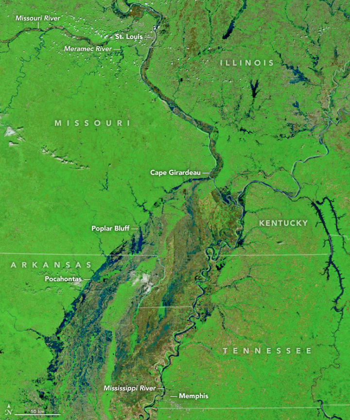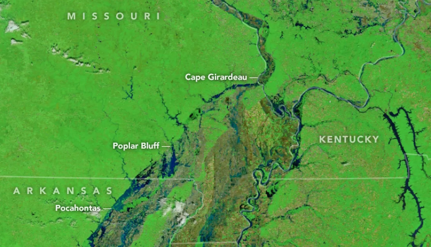
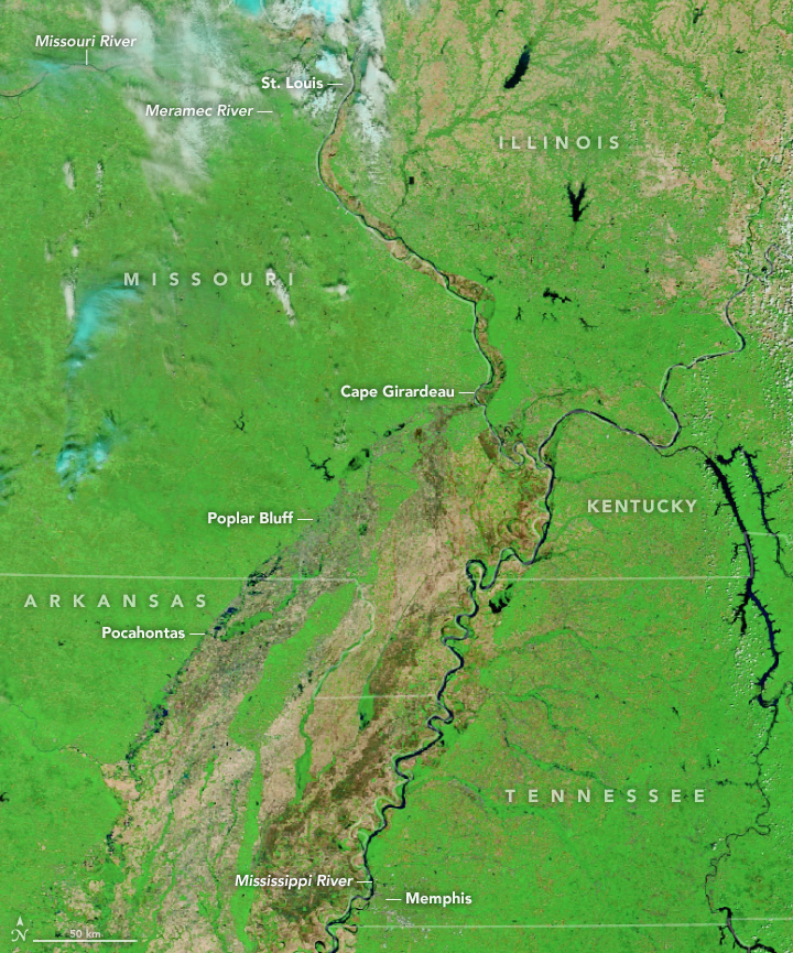
On May 2, 2017, the Moderate Resolution Imaging Spectroradiometer (MODIS) on NASA’s Terra satellite acquired this false-color image of flooding along several tributaries of Mississippi River. Flood water appears blue and black; forested areas are green. Fields without much vegetation are brown. For comparison, the image at the top shows these watersheds on April 25, 2017, under more typical conditions for the season. Turn on the image comparison tool to see the changes.
According to stream gauge data published by the National Weather Service, the Black River at Pocahontas, Arkansas, rose to nearly 29 feet (9 meters) on Tuesday, a record. The failure of a levee on May 3 forced the town to be evacuated. At Valley Park, Missouri, the Meramec River crested at just over 43 feet (13 meters) on May 2, which is just shy of a record. Forecasters say the Mississippi River at Cape Girardeau, Missouri, is on track to crest at just over 48 feet (15 meters) on May 6, which would also be a near record.
Since clouds can block MODIS images and make flood assessment a challenge, NASA’s Disasters Program is working in collaboration with the European Space Agency (ESA) to provide flood mapping products to the U.S. Federal Emergency Management Agency (FEMA). NASA processes observations made by synthetic aperture radar (SAR) on ESA’s Sentinel 1A and 1B satellites. SAR is of great value for flooding monitoring because it can “see” through clouds. In 2020, NASA plans to launch a SAR-carrying satellite called NISAR in collaboration with India's space agency.