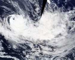
Tropical Cyclone Harold developed from a low-pressure system that was observed to the east of Papua New Guinea, and tracked to the southeast where it peaked as a Category 5 cyclone on April 6th, 2020. The cyclone brought destructive high winds and extreme rainfall to the Solomon Islands, Vanuatu, Fiji, and Tonga.
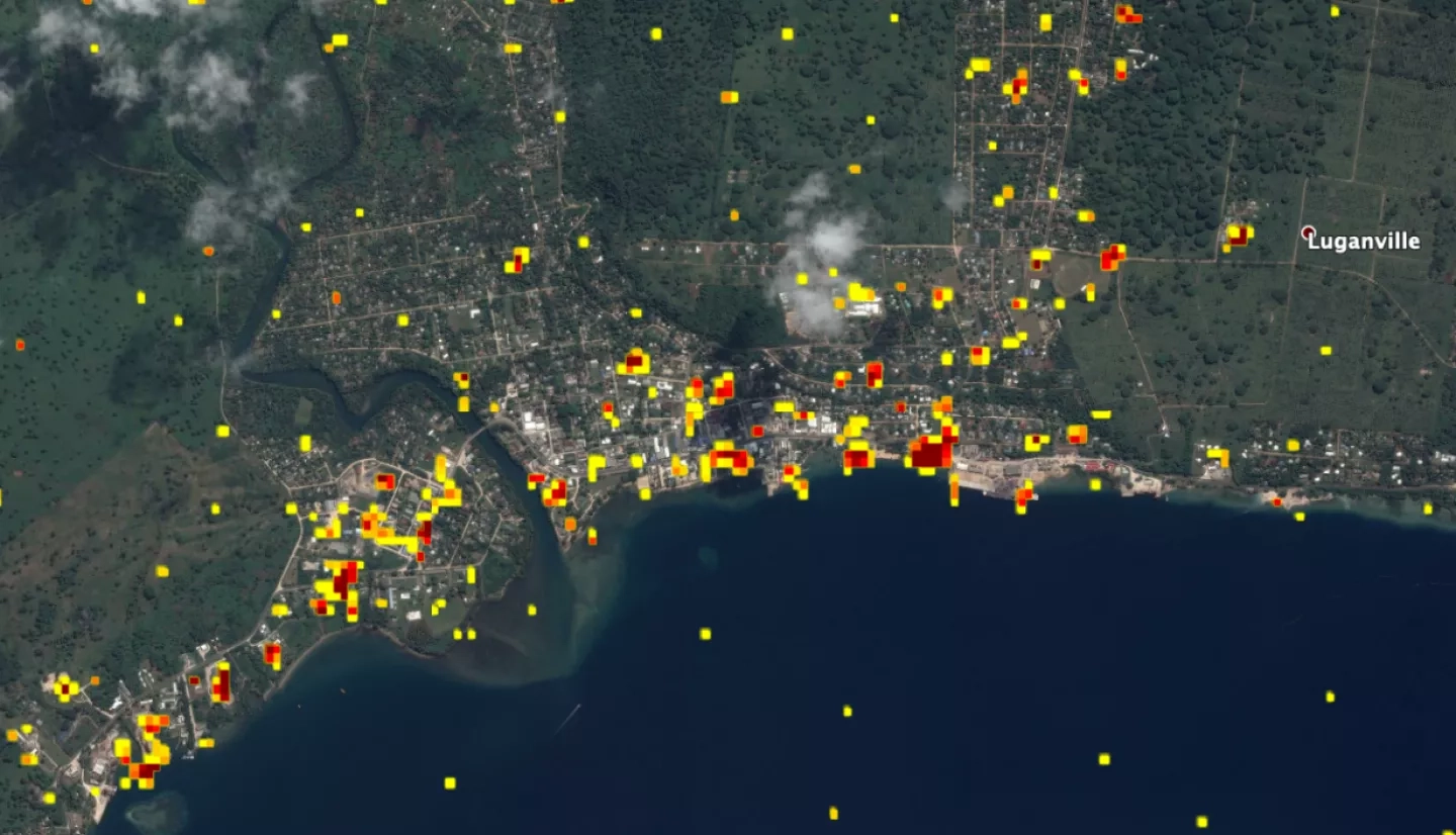
The NASA Disasters Program activated to Tier 1 response for the disaster, and responded to a request from the World Food Programme (WFP) to help identify potentially damaged structures on the islands of Vanuatu. Using Synthetic Aperture Radar (SAR) data from the Copernicus Sentinel-1 satellites, operated by the European Space Agency (ESA), the Advanced Rapid Imaging and Analysis (ARIA) team at NASA's Jet Propulsion Laboratory and California Institute of Technology in Pasadena, California, in collaboration with the Earth Observatory of Singapore (EOS), created Damage Proxy Maps (DPMs) depicting areas that are likely damaged caused by Cyclone Harold. The DPMs were generated by comparing post-event SAR imagery acquired on April 10, 2020 with pre-event images taken in March 2020.
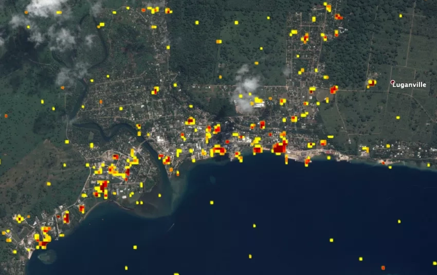
Sang-Ho Yun from the NASA ARIA team worked directly with representatives from the World Food Programme to provide these DPMs and quantify the damage. The preliminary estimates using the DPMs and building footprints from OpenStreetMap indicated 1651 damaged structures within the extent of the satellite SAR image (250 km x 380 km) that covered islands of Vanuatu. This estimates will then be verified using other satellite data and ground reports to provide a more accurate assessment of damage to the region.
Sang-Ho Yun is a principle investigator for one of the NASA Disasters Program A.37 ROSES research projects – “Using Spaceborne Synthetic Aperture Radar to Rapidly Map Global Damage”. The project focuses on building and automating DPM generation system using satellite SAR observations. This work opens the potential to explore additional tools such as translation of DPMs into a building damage ratio (the cost of damage repair), and a post-disaster construction monitoring tool to support post-disaster needs assessments and recovery efforts. The team will build product delivery pipelines collaborating with end-users, and a toolbox designed to scale with more advanced algorithms and new missions as they deploy.