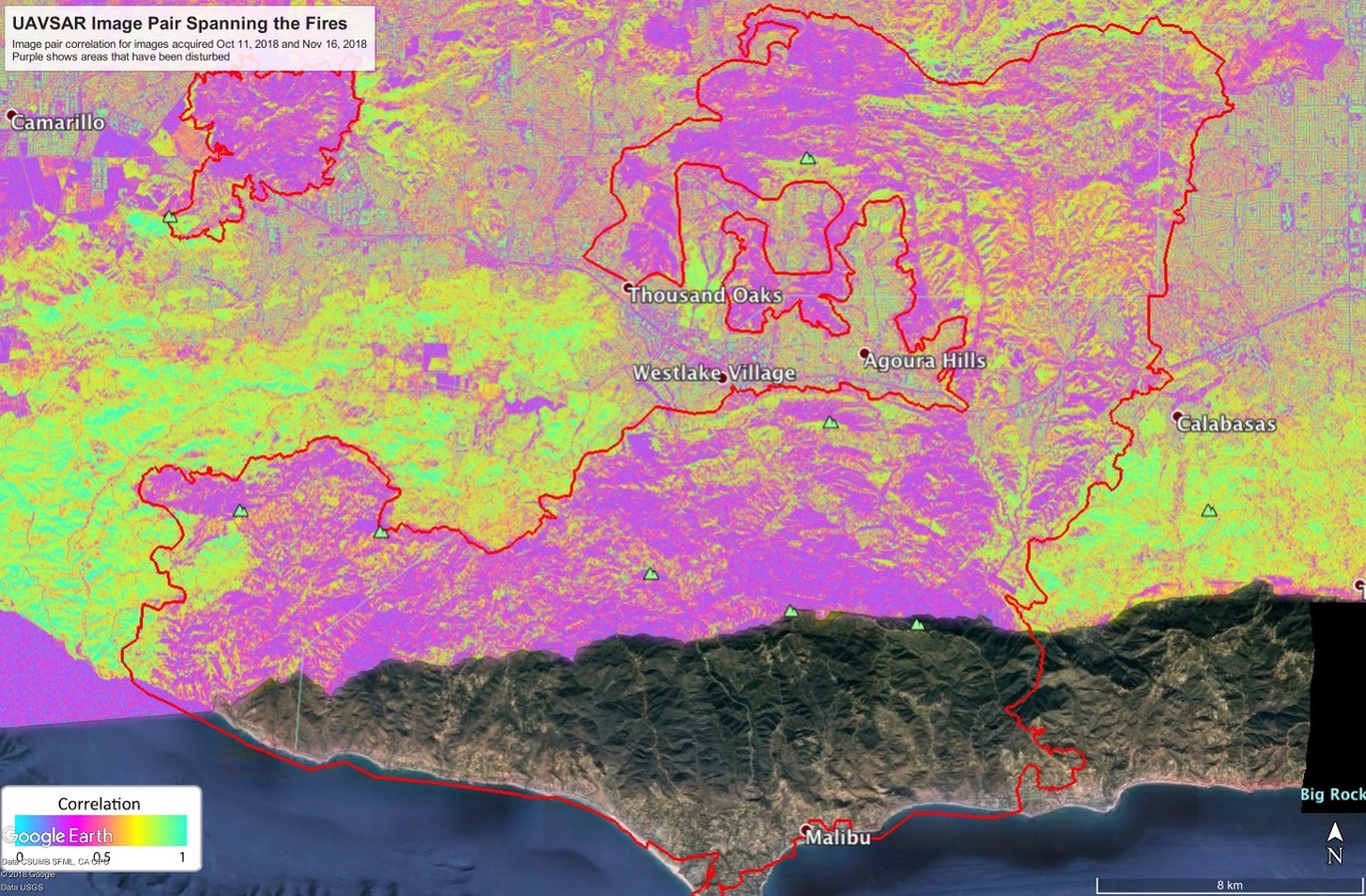
NASA deployed a research aircraft on Nov. 15 for a nighttime flight over the California Woolsey Fire. The NASA C-20 aircraft carried sensors to map the fire scar, with a goal of identifying areas at risk of catastrophic mudslides in the coming winter rains.
The aircraft took off from its base at NASA's Armstrong Flight Research Center in Palmdale, California, carrying the Uninhabited Aerial Vehicle Synthetic Aperture Radar (UAVSAR), developed and operated by JPL. The instrument can "see" through smoke, clouds and the dark of night.
UAVSAR data are often used by scientists to map ground displacement beneath the aircraft to study tectonic motion, but they can also be processed to map fire scars. The radar signals bounce off burned, barren terrain differently than they do from unburned, brush-covered hillsides.
The resulting UAVSAR image of the 150-square-mile (241-square-km) fire area shows the fire scar, including where vegetation has burned off steep slopes, destabilizing them and increasing the potential for mud and debris flows. Debris flows triggered by rainstorms after fires sometimes claim more lives than the fires themselves, as happened after last year's Thomas Fire in Montecito, about 40 miles west of the Woolsey Fire.
The UAVSAR data was then shared with the Disasters Program team to hand off to agencies including Cal Fire, the U.S. Geological Survey, U.S. Forest Service, and the National Park Service.