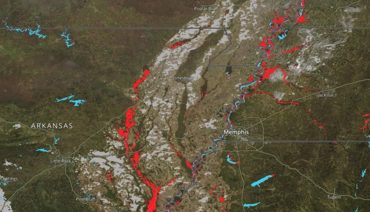
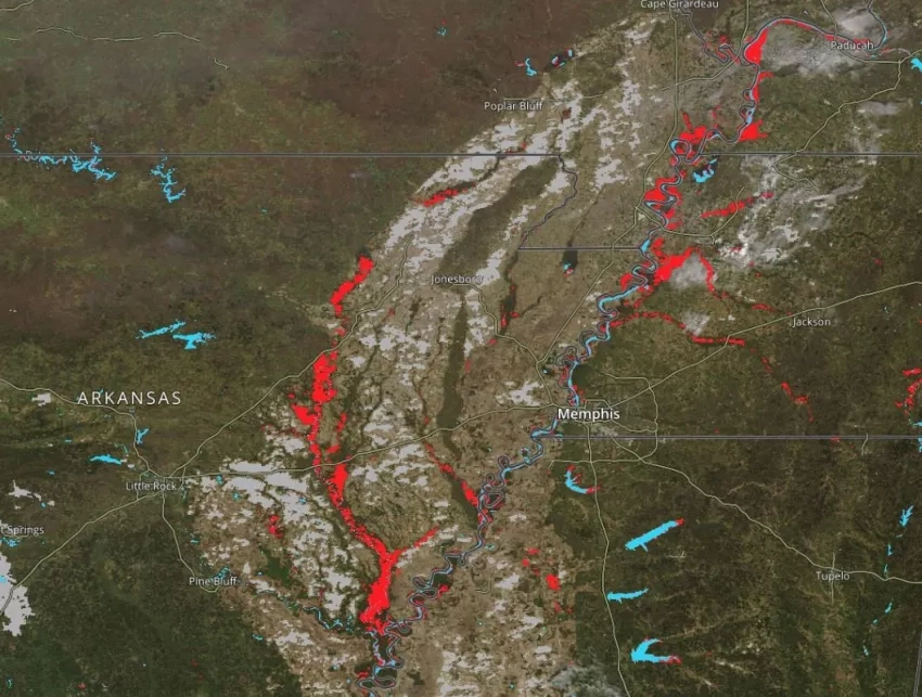
NASA’s Land, Atmosphere Near real-time Capability for EOS (LANCE) program recently developed an improved near real-time global flood product, which uses data from the MODIS instruments aboard NASA’s Aqua and Terra satellites to identify likely flooded regions. The MODIS NRT Global Flood Product was released in March 2021, and is now available for users to access in NASA’s Global Imagery Browse Services (GIBS), NASA Worldview, and the NASA Disasters Mapping Portal.
Like the legacy product, the new LANCE product is derived from the NRT MODIS Surface Reflectance datasets and the process of generating it involves three key steps: applying the water detection algorithm to each MODIS observation (from both the Aqua and Terra satellites); compositing water detections over time, to reduce errors (principally from cloud shadow false positives) and more rigorously identify water; and differentiating flooding from locations of expected surface water. However, the new product incorporates some significant changes including reduced latency, a “recurring flood” pixel value, a standardized MODIS naming convention, and a new Hierarchal Data Format (HDF) file format.
Members of NASA’s Earth Applied Sciences Disasters program area aided the LANCE team by providing feedback on the new product, including which formats would be most useful to the program’s end users. The Disasters GIS team’s summer intern, Jessica Clarke, also worked to integrate the new LANCE flood product into the NASA Disasters Mapping Portal, making it more easily accessible to emergency responders and the disaster research community. The Mapping Portal also provides access to several other LANCE disasters datasets, including Black Marble Nighttime Lights and MODIS / Terra burn scars.
The flood product is a valuable tool for end users, be they emergency response personnel looking for flood extent for a current event, academic researchers interested in flood extents for modeling or other studies, or insurance agencies looking to update flood zones. These users will benefit from the more-timely data, more robust processing, and easier browsing accompanying the new global flooding product from LANCE.
Learn more at NASA Earthdata: Near Real-Time MODIS Global Flood Product Now Available from NASA’s LANCE


