As Hurricane Zeta moves towards landfall on the U.S. Gulf Coast, NASA has eyes on the storm with an array of Earth-observing instruments and stands ready to aid affected communities with critical data and analysis. Zeta is following a path similar to Hurricane Delta, which after crossing the Yucatan Peninsula made its way across the Gulf of Mexico and struck the Louisiana coast as a Category 2 hurricane on October 9. If Zeta makes landfall as expected along the northern Gulf Coast, it will become the 7th named storm to do so in this record-breaking season, following Tropical Storm Cristobal, Hurricane Laura, Tropical Storm Marco, Hurricane Sally, Tropical Storm Beta, and Hurricane Delta. Tropical Storm Zeta is the 27th named storm of 2020, which ties the record with 2005 for the most named storms. The 2020 season is also only the second time in recorded history (the other being 2005) that the Greek alphabet has been used because the number of named storms has exceeded the number of regular names on the list. With several weeks still left in the 2020 hurricane season, 2020 is expected to surpass this previous record for most named storms in one season.
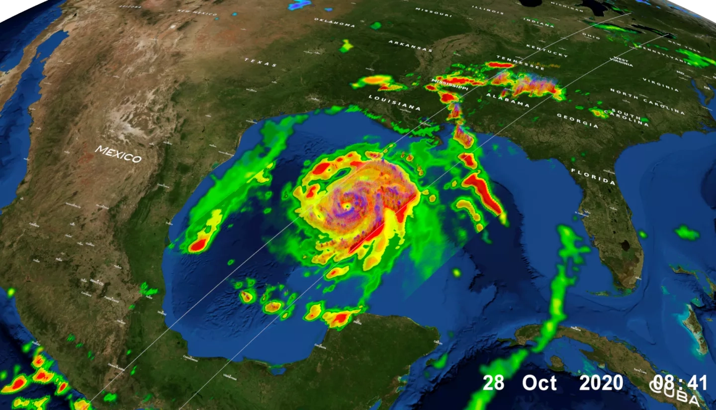
The NASA / JAXA GPM Core Observatory flew over Tropical Storm Zeta on October 28 at approximately 3:25am CDT (8:25 UTC), capturing data on the structure and intensity of precipitation within the storm.
Click here to learn more about Zeta's precipitation and its journey to landfall on the Global Precipitation Measurement Mission website
Aiding Risk Reduction, Response and Recovery
To aid local communities in preparing for and recovering from hurricanes and other disasters, the NASA Earth Applied Sciences Disasters Program coordinates a team of experts across NASA centers to provide vital Earth-observing data and analysis. For Hurricanes Laura, Sally, and Delta, the Program worked closely with stakeholders from the Federal Emergency Management Agency (FEMA), the Louisiana National Guard, and the Alabama Emergency Management Agency to provide guidance and analysis both in meetings and through data distributed on the NASA Disasters Mapping Portal. Near real-time data for tracking the storm is also made available on the Portal’s Tropical Cyclone Dashboard. The Program stands ready to continue to work with these agencies and provide assistance for Hurricane Zeta should the need arise.
As a hurricane forms and strengthens, satellites like GPM are used to track the path of the storm and gauge its intensity. Mapping of offshore heavy rain rates by GPM can provide responders with an expectation of what will occur after landfall, and data are fed into numerical weather prediction models that generate lifesaving storm-track forecasts and evacuation orders. Data derived from satellites like NASA’s Soil Moisture Active Passive (SMAP) are used to analyze soil moisture conditions in advance of an approaching storm to help anticipate the impact of heavy rainfall and identify regions which are more likely to experience runoff and flooding.
Following landfall, flooded regions can be mapped using instruments like the Moderate Resolution Imaging Spectroradiometer (MODIS) aboard NASA’s Terra and Aqua satellites, the Visible Infrared Imaging Radiometer Suite (VIIRS) aboard the NASA/NOAA Suomi National Polar-orbiting Partnership (Suomi-NPP) satellite, and the Operational Land Imager (OLI) from the USGS / NASA Landsat-8 satellite. The VIIRS-derived “Black Marble” product also allows for mapping power outages from space, which can help identify damaged areas and monitor the recovery of power in the days and weeks that follow. Should post-storm cloudiness obscure a view of the land surface, Synthetic Aperture Radar (SAR) data from the European Space Agency’s Copernicus Sentinel satellites can be used to map water extent and inland flooding. SAR data collected before and after the event can also be compared to generate Damage Proxy Maps, which can identify buildings and infrastructure that are likely damaged. Population data from the NASA Socioeconomic Data and Applications Center (SEDAC) can be combined with the Earth-observing data to paint a more comprehensive picture of the communities and lifelines impacted, and to guide aid where it is needed.
Combining these multiple datasets and tools allows NASA to see the big picture of a storm and its impacts, and helps answer broader questions about how communities can better prepare for, and recover from, the storms of the future. For Hurricane Zeta, researchers will have a unique opportunity to gauge the vulnerability or resilience of a region that was recently impacted by several destructive storms, and to study their compounding effects. Attempting to determine what damage was caused by which storm will be a challenging task on its own. However, attempting to answer these tough questions can provide critical guidance to help communities build back better and strengthen them for the disasters and challenges that lie ahead.


