Researchers from the MISR Active Aerosol Plume-Height (AAP) Project, based out of NASA Goddard Space Flight Center in Greenbelt, Maryland and the University of Maryland, used data from NASA's Terra satellite to map the properties and near-source dispersion of smoke plumes from California’s Milepost 21 wildfire that burned during August 2020.
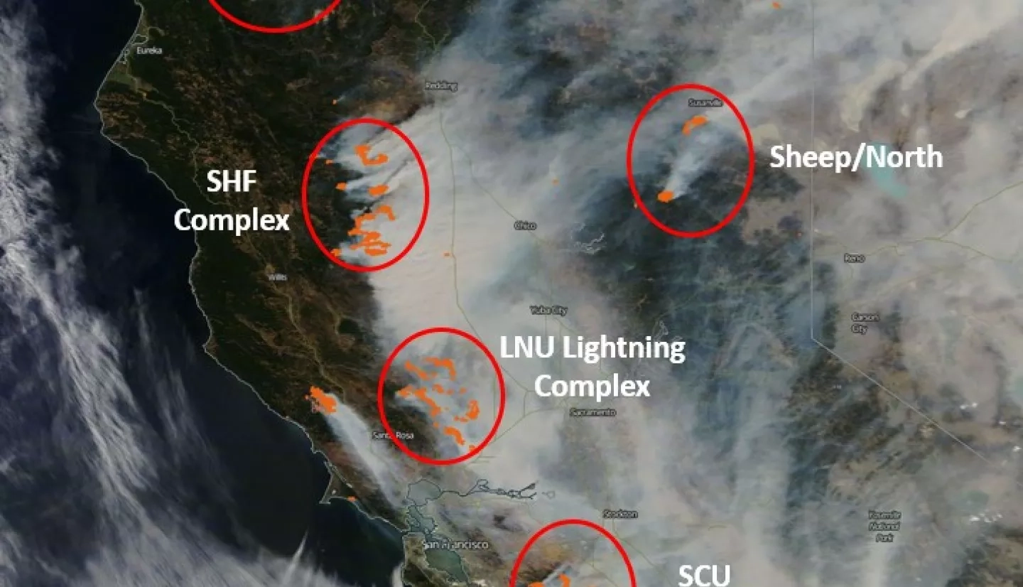
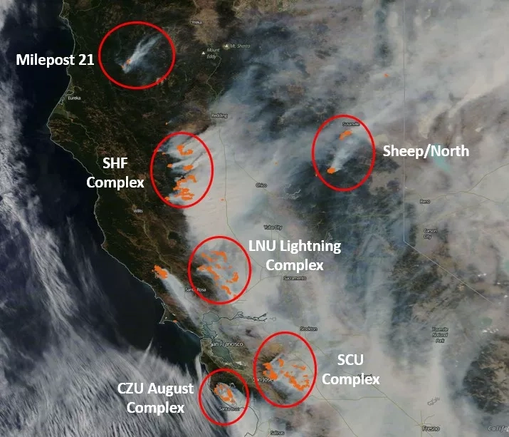
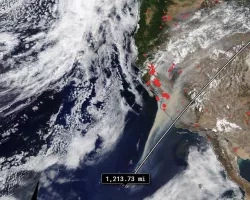
At least seven major wildfires were burning across California as early as 10:30 a.m. PDT on August 20th, 2020. They are identified as hot-spots at 4 microns wavelength, highlighted as red dots and superposed on this true-color image from the Moderate Resolution Imaging Spectroradiometer (MODIS) instrument aboard the NASA Terra satellite. Wildfires tend to increase in intensity during the day, and fire activity usually peaks in the late afternoon.
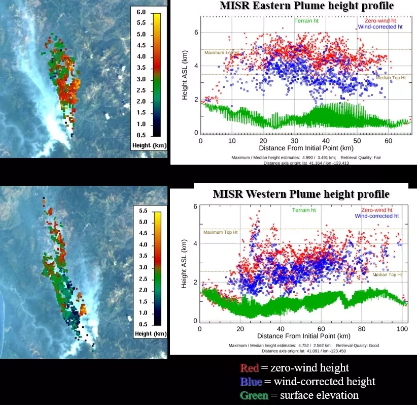
The Multi-Angle Imaging Spectro-radiometer (MISR), orbiting aboard NASA’s Terra satellite, obtains less coverage than MODIS. However, MISR stereo imagery makes it possible to map injection heights and associated wind vectors for wildfire smoke and volcanic eruption plumes. With these data, we can also retrieve smoke particle properties, track their evolution downwind, and distinguish them from metrological clouds.
On August 15th, 2020, MISR observed the Milepost 21 fire dispersing northward over Humboldt county in northern California. Two hot spots are shown in the figures above. The eastern part of the plume reached 4 km elevation, which is likely above the near-surface planetary boundary layer; at that altitude smoke tends to stay aloft longer and travel farther. The western part, at 2-3 km aloft, was apparently less intense, but it extended at least 60 km northward from the source. At plume elevation, winds were as high as 16 meters per second, based on the MISR retrievals.
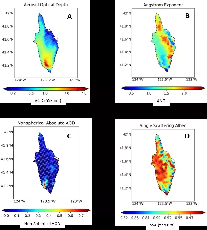
Shown in the image above, the MISR Research Aerosol (RA) retrieval algorithm produced: (A) aerosol total-column amount (optical depth – AOD), (B) an aerosol size constraint (Angstrom Exponent (ANG), which decreases for increased effective particle size), (C) AOD of non-spherical particles, and (D) particle light-absorption (SSA, equal to 1 for non-absorbing particles, and <1 for darker particles).
In the Milepost 21 smoke plume, AOD reaches ~7 and the particles tend to be large (ANG ~0.5) and dark (SSA ~0.9) very near the fire. However, AOD decreases rapidly away from the source. Within 10 km downwind, differences between the two main sources are reflected in plume properties. The eastern, more intense source, generated small (ANG >2), dark (SSA ≤0.9) particles MISR identifies as black and brown carbon. The western part of the plume is dominated by medium (ANG ≤1.3), brighter (SSA ≥0.96) particles. The particles are mostly spherical throughout, except near the western source, where soil might be mobilized, and ≥50 km downwind, where background aerosol contributions are likely to be significant.
Coordinators from the NASA Earth Applied Sciences Disasters Program are providing these air quality products and analysis to stakeholders from the California State Guard, who have requested products to aid damage assessment, quantifying infrastructure and residential risk, fire propagation modeling, and air quality monitoring/modeling. The Program is also supporting stakeholders from the California Geological Survey, FEMA Region IX, California State Geographic Information Officer, California Office of Emergency Services (CalOES), and the California Department of Forestry and Fire Protection (CAL FIRE).
