NASA and the city of Rio de Janeiro have extended an agreement to support innovative and collaborative efforts to better understand, anticipate, monitor and respond to natural hazards and other impacts affecting the city. The collaboration leverages the unique attributes of NASA's satellite data and modeling frameworks and Rio de Janeiro's management and monitoring capabilities to improve awareness of how the city may be impacted by hazards and affected by climate change. The original five-year agreement was signed in December 2015 and was designed to share data, models and scientific and management expertise.
The renewed agreement continues the partnership for an additional five years, providing crucial continuity in monitoring hazards and environmental issues such as heavy rainfall, landslides, air quality, water quality and climate change impacts in and around the city.
Over the next five years, NASA and Rio de Janeiro team members plan to advance their shared goals in two major areas: first, in advancing science to improve situational awareness and response efforts for environmental disasters, and second, in propagating science throughout local schools and the general public.
In addition, the partnership will allow for new data applications such as the development of an urban flood model for the city. The model will be incorporated into NASA's Land Information System, transferred to Rio de Janeiro's data infrastructure, and then implemented within the city’s Municipal Urban Information System, known as SIURB. The joint effort tracks how city rain gauges compare with satellite precipitation data, which helps scientists and decision-makers better understand the types of extreme rainfall events that contribute to flood and landslide conditions.
Applied Sciences Director Lawrence Friedl's remarks at the 2021 extension of the agreement between NASA and the city of Rio de Janeiro.
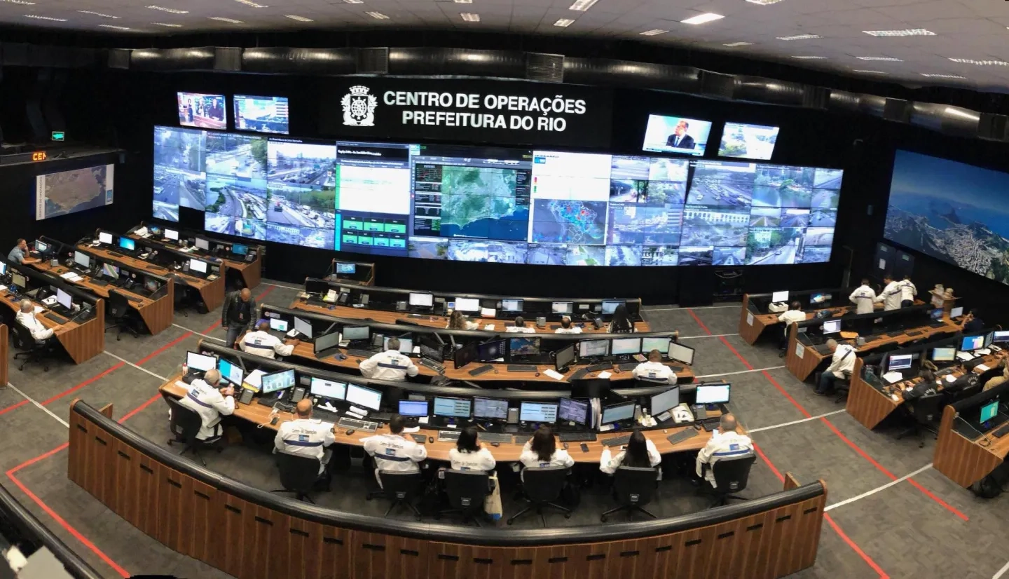
Over the first five years of this partnership, the team made significant progress in developing and implementing hazard modeling within the city. Rio was the first local and operational implementation of NASA`s Landslide Hazard Assessment for Situational Awareness (LHASA) global landslide model, a project funded in part by NASA’s Earth Applied Sciences Disasters program area. In the upcoming summer, LHASA Rio will be one of the triggers used to decide whether the city will change its operational level during rain events.
Read the full article on nasa.gov: NASA, Rio de Janeiro Extend Disaster Preparedness Partnership


