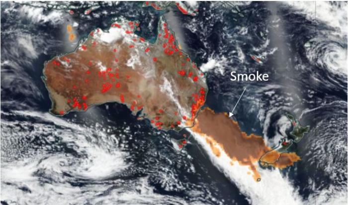
On New Year Eve 2019 a series of massive thunderstorms generated by devastating fires across the states of New South Wales and Victoria in Australia produced a gigantic smoke layer of 1.75 million square kilometers across the Tasmanian Sea, as observed by the VIIRS and OMPS instruments onboard the NOAA/NASA Suomi-NPP satellite (figure 1).
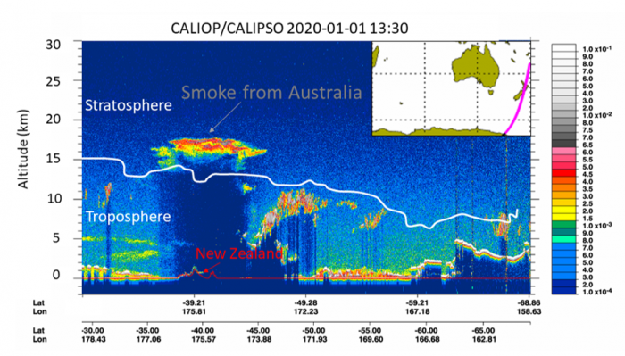
Through the sharp eyes of the space-borne lidar onboard the NASA/CNES CALIPSO satellite, it was revealed that the smoke plume had crossed the boundary of the troposphere and was deep into stratosphere above New Zealand (figure 2).
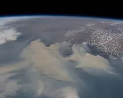
Subsequent observations from CALIPSO showed the transport of the plume across the South Pacific Ocean rising to an altitude of nearly 20 kilometers, as seen in the above video. The radiative heating from the soot particles within the smoke makes wildfire plumes particularly buoyant.
The CALIPSO lidar offers a unique viewpoint to follow smoke and volcanic plumes into the stratosphere thanks to its high vertical resolution. The combination of backscatter and depolarization measurements from the lidar allows researchers to differentiate between aerosols and clouds.
Researchers are currently working to answer questions such as how long the plume will stay in the stratosphere, whether it will produce a noticeable climate impacts at the surface, and whether the ozone layer will be affected. The NASA Disasters Program is also studying the climate risks associated with this event.